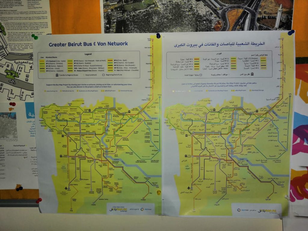
It’s been a busy six months since we first launched our second edition Greater Beirut Bus & Van Map during Beirut Design Week; our team has grown, and our reach has spread. Have you spotted the map in the wild yet? After distributing it quietly in different cultural centers in Beirut, the team went out last Sunday to reconnect the map with its territory: the transit system itself! Big thanks to Alaa for all her help and summary below:
by Alaa Salam
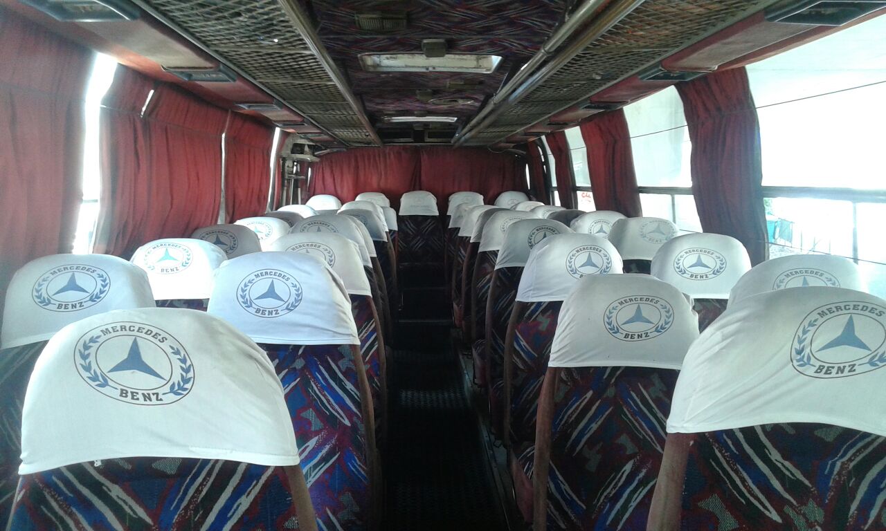
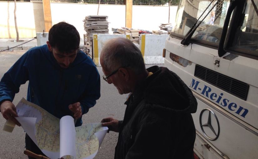
It may have been a Sunday, but that didn’t deter the Bus Map Project team from taking some bus maps and heading out for work. Joining forces with the production team of Beirut Mini Maker Faire, we sat down for some map prepping. The aim was to hang up as many maps as possible on buses, from lines 2 and 12.
We moved out early, energized and prepared to take the challenge head on. We were met with an amazing, cooperative spirit from the bus drivers. In fact, some drivers came in and helped out! The head (“mas’oul”) of the bus lot even took 16 more maps to distribute amongst the remaining buses.
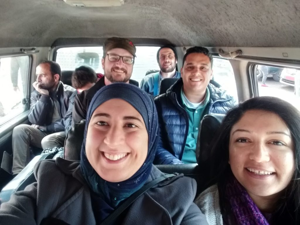
Afterwards, we took Bus Number 12 to Cola, where we took a van heading out to our next destination: Saida! 45mins and a couple of selfies later, the team reached the beautiful city. Encouraged by the great weather and welcoming bus drivers, we hung up an additional set of maps in Saida’s main van lot.
The Saida van lot drivers loved the Greater Beirut Bus Map so much that they inquired about the one for the South. We assured the drivers that the map is a work in progress — we will be working hard on getting it done! With their help, of course!
Feeling triumphant, we treated ourselves to some falafel and a boat ride around the islands. After such a successful day, we started heading back to Beirut, dreaming of bigger campaigns. But while on the road, we were surprised my messages from some of the drivers we’d met on line 2 and 12.
They were sending us photos of themselves with the map! Each of the drivers had taken a copy and expertly set it up in his vehicle — then posed with it! The drivers also expressed their deep gratitude to the team and congratulated them on such a wonderful effort. This was the biggest pat on the back the team could have received.
All in all, Sunday was a day to remember by both teams. But the real treat here is: can you #SpotTheBusMap? Stay tuned for additional news and a couple of surprises! From all the members of Bus Map Project, we wish you always have a great bus ride!
Lack of information is the main obstacle stopping many people from using public transport in Lebanon. This issue, and the fact that this gap in public knowledge has too often been filled with simplistic myth or exaggerated legend, is the raison d’être of our project.
But overcoming this obstacle, in our view, is not just a matter of taking on the role of the cartographic “Godot” we’ve been waiting for; Bus Map Project has been and still is stubbornly insistent on pushing the problematic beyond the quick-fix mentality: if you’re interested in riding the bus in Lebanon, you can either choose to remain an outsider, or you can take a leap of faith and engage with the system to learn about it first-hand, route by route, journey by journey, contributing to a collective map that isn’t dropped from the sky, but rather, has been laboriously tended to, and is chock-full of living history.
Today’s #RiderStory introduces Clément, a French hiker who shares our zeal, and who has taken it upon himself to figure out the system at its very fringes. Building up a library of experiential knowledge, Clément has been sharing his discoveries and tricks on his hiking website, as well as contributing to our collective mapping process. In this post, we reflect on his learning as a way of better expressing our own.
*
« The Lebanese bus system can seem difficult to access for neophytes, but once you start asking people on the ground, it can be figured out smoothly and little by little. My first time in Dora as a foreigner was quite an experience, but now I get around very easily there, » Clément explains. His first experience taking the bus was on a well-known route, the very busy Dora-Byblos line. He then started exploring lesser-known routes, learning about the system empirically and piecing together the bigger picture route by route. « I was surprised by how little information there is on public transport in Lebanon. One good way of seeing if the system is understandable to outsiders is to see whether foreigners are able to access it or not. I noted that the routes going from Cola to the South and Dora to Tripoli are indeed used by foreigners -– who hear of them by word-of-mouth -– but the rest of the routes are pretty much used only by locals who need the buses to reach their villages or workplaces. »
Clément’s reflections bring up a very interesting “epistemology” or theory of knowledge for a city like Beirut. We often say that our project attempts to make Beirut “more legible,” which is a word that evokes a very visual, or even textual, way of engaging with the city. It’s the kind of engagement described in Kevin Lynch’s “The Image of the City”, a classic in the urban literature. In it, Lynch talks about the « highly imageable (apparent, legible, or visible) city [as] well formed, distinct, remarkable; it would invite the eye and the ear to greater attention and participation…Such a city would be one that could be apprehended over time as a pattern of high continuity with many distinctive parts clearly inter-connected. » We hesitate to try and analyze Beirut by this definition; at the very least, we’d double and triple underline the “over time” part of that sentence. Instead, Clément’s observation of how Beirut’s transit system is gradually apprehended by outsiders through word-of-mouth is an important reminder of the fact that visual representations of a city — like mapping — will miss a lot about how a city like Beirut actually functions. Even Lynch admits that there are other properties in “beautiful environments,” like « meaning or expressiveness, sensuous delight, rhythm, stimulus, choice » — these are aspects of urban life that are too easily sacrificed when the issue of public transport is reduced to a problem of “lack.” As Jenny Gustafsson once wrote in a popular article on ‘mapping Beirut-style,’ « Maps, when functioning well, become an extension of our knowledge » — to which, we add the important caveat: maps can also easily become dysfunctional if they crowd out or colonize other ways of knowing.
Clément’s empirical discoveries allowed him to develop tricks to make the most of the system, and speak in the urban vocabulary and grammar more fluently: « In Dora for example, it is better to stand further from the bus stop and hop on a bus that is already on its way, rather than waiting at the bus stop for a bus to fill up and go. » Another clever strategy is to take a van rather than a bus when going to a far-away place like Tripoli: they fill up more rapidly than buses and hence will go straight to the final destination without stopping every few kilometers to pick up clients. What map can teach you that? Quoting from Jenny’s article again, it is important that transit solutions in the Middle East take seriously the way that MENA cities are actually put together: « It’s about learning how a city works. There’s usually a very clear order; you just have to understand it. »
After getting in touch with us, Clément started volunteering his time for Bus Map Project exploring new and obscure routes, tracking the Cola-Niha line for example, among others. « I think it is a challenge to map the informal system because here people are used to orienting themselves differently, with landmarks rather than streets for example. The only map I was able to find was the Zawarib one for Beirut buses. However, I found it quite difficult to use; it looked like a metro map and some routes were outdated, » he explained. The predominance of the metro-style or “Tube map” is not just a matter of aesthetics; it is a deliberate choice to represent the city in a very particular way, one that sacrifices much too much cultural nuance for the sake of supposed clarity and visual appeal. One of our friends who produced a transit map in another city in the region once lamented to us how little their highly-schematic map was being used by the general public, saying that « people here aren’t used to reading maps » — we’d turn that problem on its head, and say, instead, that people here aren’t used to valuing how people here actually are (think, live, and get around). Mapping MENA-style is indeed a very real but worthwhile challenge.
Among Clément’s repertoire of urban tactics was learning to avoid congestion by deftly choosing internal versus external routes to get around faster; for example, hopping on the external Bikfaya-Dora line to get from Sin-el-Fil to Dora. These are tricks that can only be learned over time. « Lebanese people are often surprised when I explain that I take the bus; I’m guessing the lack of information available contributes to unnecessary stigmas such as danger or violence, which is very far from the truth, » he reflected. We’d add that the lack of information is also an opportunity to contribute more intentionally to the city-making we are always already part of — Clément’s tips and tricks are urbanism, no less important for shaping the city than any engineering blueprint or national land transport strategy.
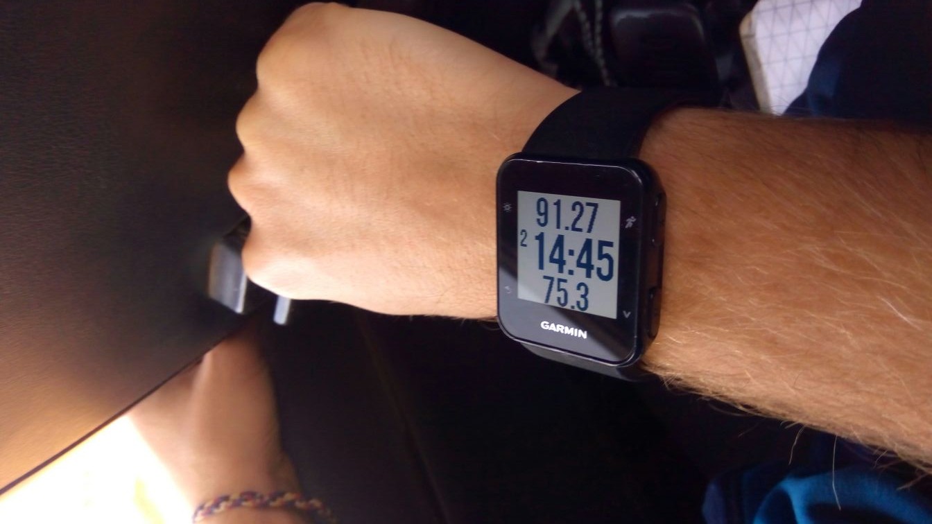
Clément’s watch, that he uses to track the bus routes
Sensing that he is contributing to something larger than himself, Clément started a hiking website to share his transit discoveries. « I am a hiker and I wanted to explore Lebanon by myself, but I quickly figured out that all hiking websites took it as a prerequisite to have a car to get to the trails. So I started tracking the bus routes I would take using my watch and uploading them on my website. » By documenting his experiences with routes, precise information and pictures, he encourages and equips wanderers of all kinds to experience Lebanon differently. « I am just sharing the information I would have liked to have had when I arrived here in January. The website of the Lebanon Mountain Trail is very complete but does not display any information on how to get to the trails by public transport. The travel agency Living Lebanon gathers some useful routes, but not all of them; it’s the same for the WikiLoc portal. » While a lot of hikers in Lebanon go on organized group tours where everything is taken care of, Clément’s sharing of information is an invitation to explore, learn and document more individually and freely. And in doing so, helps us connect the dots between two engaged, but previously-disconnected communities that #LiveLoveLebanon in the city and beyond.
Are you a transit rider? Do you want to contribute to our project? Email us at hello [at] busmap [dot] me
Last week, five of us from the Bus Map Project team (Chadi, Jad, Mira, Haifa and Sergej) had the pleasure of participating in a Regional Exchange conference organized by FES Cairo and A2K4D around the question of transit and mobility in the MENA region. The conference brought together grassroots mapping initiatives and various stakeholders from the engineering, advocacy and research worlds from the MENA and beyond, to spark conversations, explore synergies, and engage in new creative thinking about how to work with the infrastructures and ‘infostructures‘ we find ourselves in. Though we had different perspectives and experiences, our shared aim was “making a shift from car-oriented cities to people-oriented cities” across the region. In this post, Mira reflects on some of the interesting points of convergence and tension that came up during the conference:
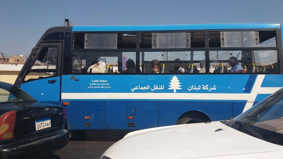
“The Lebanon Company for Mass Transit” — an unexpected encounter in the streets of Cairo
“A developed city is not where the poor have cars, it is where the rich use public transportation” — these words by Gustavo Petro opened the conference hosted by the American University in Cairo, in the iconic Oriental Hall of the historic Tahrir Square campus. The two days of discussion linked up stakeholders across the pro-transit spectrum. Panels included Dr Ayman Smadi, former Director of Traffic and Transport at the Greater Amman Municipality and current Director of the MENA branch of the UITP, and five transit mapping initiatives, big and small: Transport for Cairo, (Egypt) Ma’an Nassel (Jordan), Digital Matatus (Kenya), WhereIsMyTransport (South Africa/UK), and of course, our humble Bus Map Project representing Lebanon.
Much to our enthusiasm, actors from such different perspectives seemed to have reached very similar conclusions: to tackle mobility issues in cities where there are large gaps in transit provision, the most effective way for encouraging new patterns is to rethink our old, top-down planning tropes.
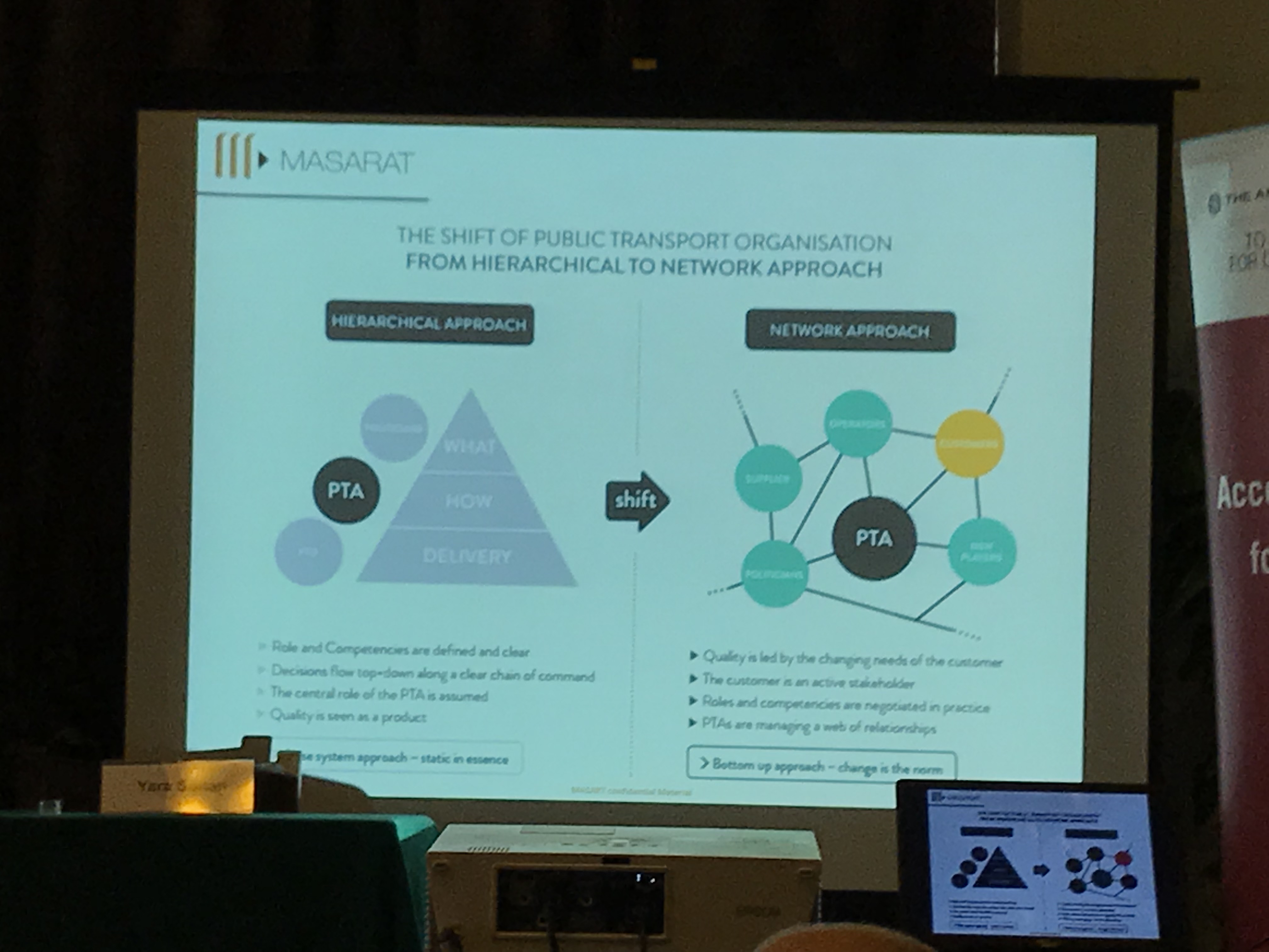
As Dr Ahmed Mosa from MASARAT put it, a crucial shift is needed in public transport organization from a hierarchical to a network approach. This surprising language from an engineer and planner helped us see that there are openings for grassroots mapping initiatives like ours to enter the policymaking conversation. Our bus riders’ perspective becomes a policy instrument and a way to give birth not only to technical solutions but to deeply sustainable ones, rooted in incremental change and the gradual adoption of new behaviors.
As the subject of informality came up again and again, we were encouraged to challenge more and more the categories and frames that shaped what we believe to be true regarding our transit systems. Dr Jacqueline Klopp from the Center for Sustainable Urban Development at Columbia University questioned the terminology used to describe the transit gap-filler: is it even relevant to call these buses and vans informal, when they are so ubiquitous and deeply embedded in society? And why is “elite-informality” tolerated, while the mobility practices of the poor are completely unacceptable? Mohamed Hegazy from Transport from Cairo suggested a more neutral term for informal transport — “paratransit” — but the question remains: what is at stake in holding on to language that neatly differentiates between centrally-regulated state-owned mass transit and privately-operated public transport?
We have always referred to the buses and vans we use and map in Beirut as “existing transit” for this very reason, and are happy to see more questions being raised about the categories we’ve inherited for understanding our cities.
A slide from our presentation
The obvious nature of “data” itself was also challenged and questioned. As Dr Sarah Williams from the Civic Design Data Lab at MIT pointed out, data is only useful when it is built into a tool that benefits the public. So how can we use the data collected to highlight inequality in access and service provision? Visualizing data through a map is a powerful way to stir up and steer the conversation about accessibility, for example, but are there other ways to turn data into useful information? This is a question also raised by Bianca Ryseck from WhereIsMyTransport, who said that, as an urban sociologist, developer-focused platforms aren’t always useful for her. While many stakeholders are interested in transit data to make smart planning decisions, it is important to remember that, as Jad put it, data is “a bridge but not an end goal.”
This is why, for our project, the way we do data collection is just as important as what we do with it.
If, following Chadi’s words, transport is mirroring our society, then as citizens, we have the direct power to implement change by shifting our behaviors. What are our rights and duties regarding mobility in our cities? Isn’t the least we can do to engage with the existing system to try and understand it better? We often quote Wim Wender in our presentations, so here’s another point to consider from a cinematic auteur: “Confidence is what you have before you understand the problem,” says Woody Allen — hence, unlearning our pre-conceived ideas about mobility will eventually help us realize that maybe, just maybe, our transit problems don’t lie where we think they do. We need to rethink our questions so we can work on answering them step by step, with more efficiency and more inclusiveness.
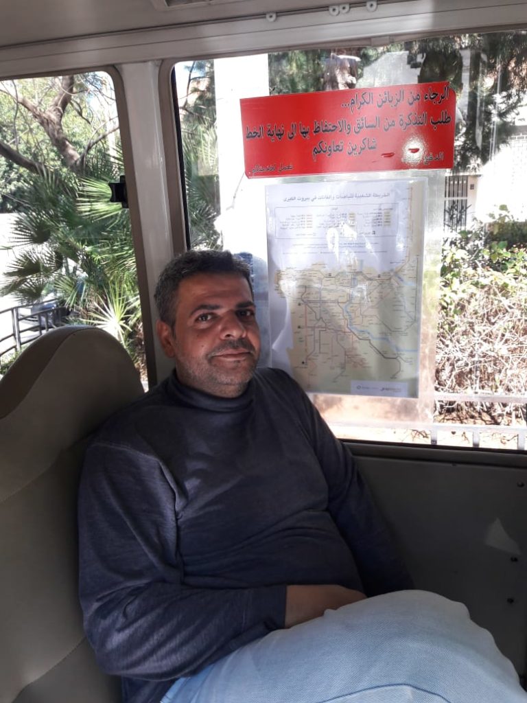
This summer, Bus Map Project gathered a team of volunteers from AUB with one aim: tracking as many of the bus routes that originate from Beirut as humanly possible. In this past month of August, we drew our focus on the Cola hub, a well-known transit intersection in the capital, to list and track all the routes departing from there in a grassroots and organic way. The ultimate goal of this collective mapping action is to produce a map pieced together by individual transit users so that more people get to know and trust this dynamic system of buses in Lebanon.
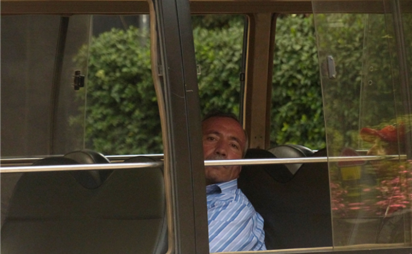
This is Ali, a driver we met while scanning the hub; he drives the oldest bus in Cola, dating back to 1973.
To the eye of the novice, getting around the Cola intersection can seem like an impractical imbroglio. However, as soon as one starts opening her eyes and engaging with riders and drivers, the entangled web of routes becomes almost limpid — maybe even enjoyable. To palliate the deficiency in state organization, the informal transit built its own tanzim, with bus stops for every route, coordination between different lines that pass through the same cities, and sometimes even set timetables.
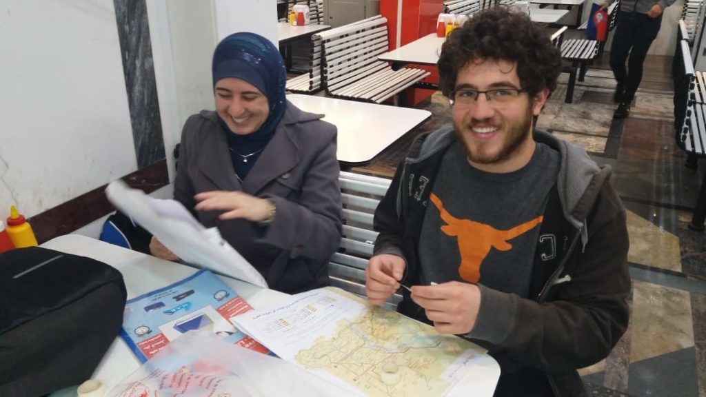
To get a sense of the full scope of the hub, our first step was to collect routes by word-of-mouth, or more specifically, word-of-twitter. We then went to Cola one morning and engaged with the drivers and riders to actually “scan” the hub, to get a clearer understanding and list all the routes originating from Cola. Once our list of almost 30 different routes was organized, our Collective Map Action truly began: the team of volunteers started tracking the routes and criss-crossing Lebanon to gather not only geographic data (i.e. point A to point B), but also facts on sizes of fleets, timetables, frequency of trips and prices of tickets.
For as little as 1500LL, the Collective Map Action provided us with a unique opportunity to (re)discover some beautiful — and less beautiful — places of Lebanon, and simply enjoy the feeling of drift and lull that takes over when one rides the bus only for the sake of discovery.
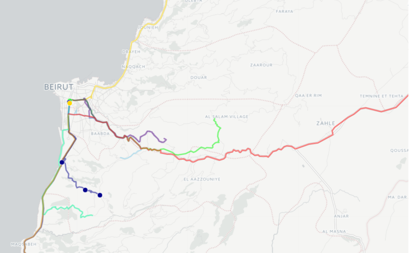
Sara and Sirene tracked a van tracing the route from Cola to Choueifat to Khalde, and back again. Here is part of that journey:
Rashad went on a trip from Cola to Baakline:
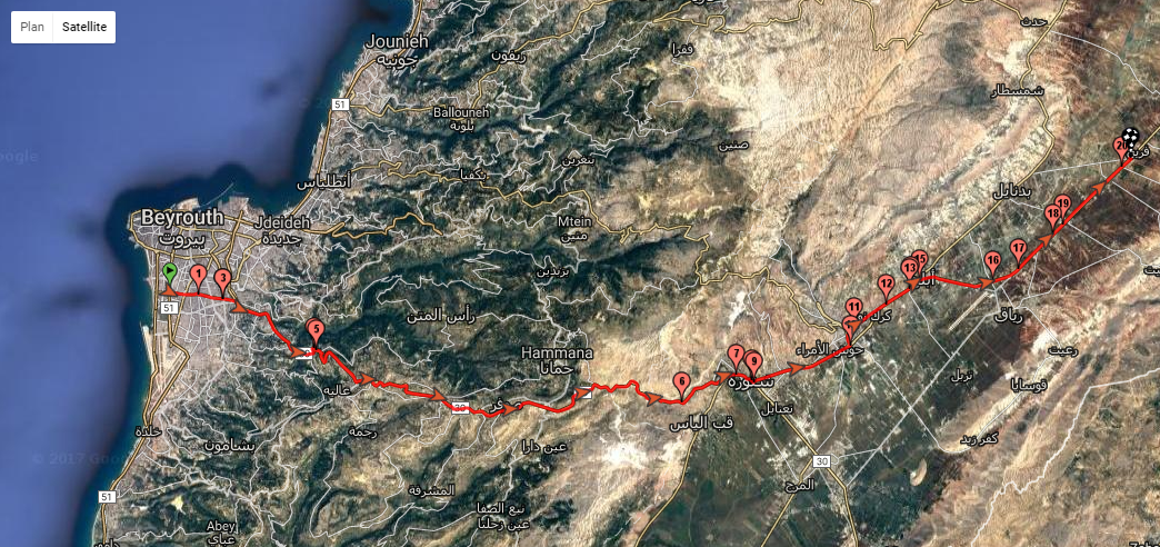
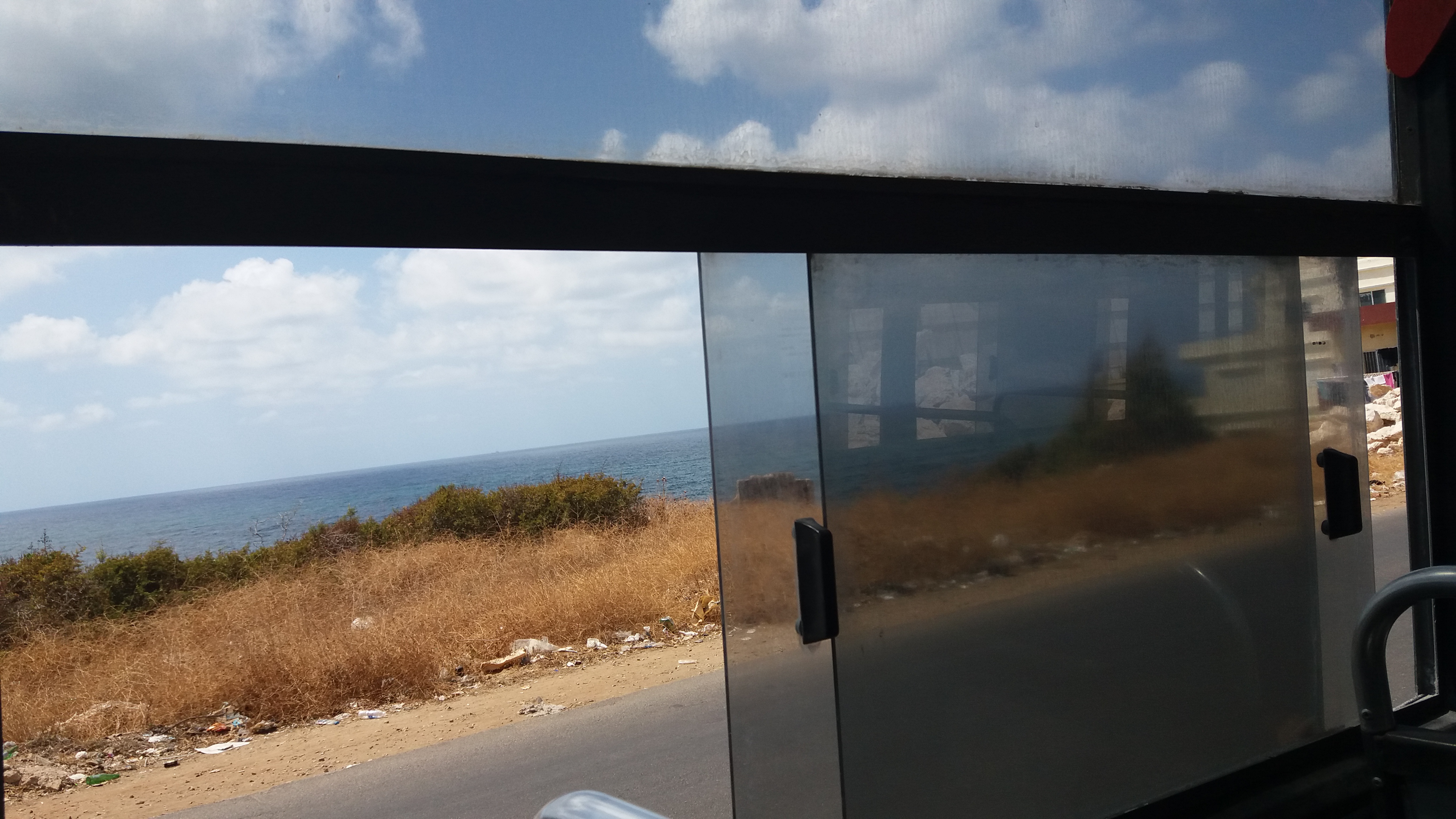
And Ali traced his way to Aramoun and Qabr Chamoun:
Here, the first difficulty arose: while there indeed is a regular van that ends at Aramoun, the drivers often continue to Qabr Chamoun when some clients want to get there; this is what happened the two times we tried to track the van, raising the question: to what extent is it possible to produce a formal map that faithfully reflects a truly informal system? And shouldn’t this informality, instead of being seen as a lack of organization, be considered a dynamic and flexible vector of increased mobility? The design challenge is an exciting one, as any map worthy of reflecting Beirut needs to figure out how to communicate these nuances.
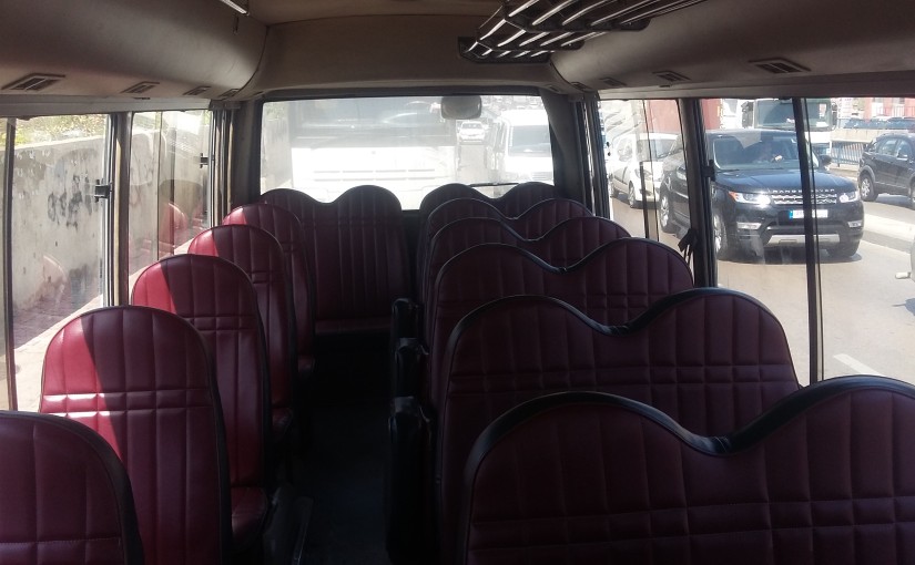
Interior of the bus going from Cola to Debiye
While the team prepares to wrap up Cola and track the last few obscure and infrequent routes, the Collective Map Action of this month also forces us to think about the trap of romanticization. Whenever we explained to drivers that we were riding buses only to figure out where they went, we were met with amused and startled glances, and even a little bit of “mesmerization” — particularly when we admitted that we quite enjoyed the rides; one female passenger on the Number 13 noted that “it’s because you do it for fun, you’re not stuck every day in two hours of agonizing slowness and traffic during your commute.”
While a major “edge” that our team has is that we indeed daily users of buses for commuting or for travel, this was a gentle reminder to be careful about exoticizing or objectifying ‘bus culture,’ and to keep in mind that public transport is always primarily a fulfillment of a basic economic and social need, and not some kind of privileged surrealist experiment.
Finally, this month brought to the fore the real value of privileging a grassroots approach to mapping, instead of conveniently having one single person track all the routes. While a collective approach is harder to manage, organize, and takes more time to build up momentum for, this methodology benefits from diverse perspectives, insights and experiences, and contributes to creating a map that reflects the realities of as many riders as possible. This, in turn, works to open up a conversation about broader social and developmental issues.
Earlier this year, we launched a series on women’s experiences of public transport in Lebanon, which we opened with a post about ‘first impressions.’ This summer, we are leading a Collective Map Action with a group of students, some of whom have never taken a bus before. Here’s the story of two new bus riders:
How Can Public Transportation Curate your Perception of the City?
by Mira Tfaily
Of all the reasons that could push someone to climb into a Lebanese bus, one of the most fascinating is curiosity. This is the motive that led Sara and Sirene, two AUB landscape architecture students, to take part in the Bus Map Project’s summer mapping initiative as volunteers. With the academic background they are bringing with them, the two young women reflected on the way their first-hand experience as bus riders has shifted their perception of the city:
“We took Bus 15 from Ain el Mreisseh — we weren’t sure where it was heading, so we decided to stay on the bus, to see if it would take us back to Ain el Mreisseh. We had to take another bus at Dora; the whole trip took us 2 hours,” they explained, as they told me about their very first bus ride. Taking the bus without knowing where it was going became a new way to marvel at things they usually pass by without noticing. From this perspective, public transportation can be a way to awaken curiosity, raise new questions and imagine new answers.
“Usually, we travel the city by car or by walking. We had some misconceptions before taking the bus; mainly about danger and uncertainty. However, now that we have taken it, our prejudices have somehow vanished. It’s really easy and affordable to use. It isn’t particularly dangerous for a woman to use. You always have to be careful — not because you’re in a bus, but because you’re in Lebanon.”
Sara and Sirene still see that lack of information is the main problem regarding buses. “We were asking riders for information. Most of them did not have any idea regarding the final destination of the bus, but rather, they knew that the bus would pass by the place they were going to.” However, by choosing to go beyond this uncertainty, the two volunteers subverted their lack of familiarity with the whole system into a new way to poetically apprehend the urban environment we all are entangled in.
Their second trip was much more ambitious, and saw them taking a van from Jnah to the Bekaa Valley. This experience allowed them to think of and speak about the bus as a truly public space, appreciating the social diversity that is ‘consubstantial’ to their own being. Buses are part of the urban environment, but they still remain invisible to a large part of the population that knowingly or unknowingly chooses not to see them.
“I don’t think we have a culture of the public space in Lebanon. Moreover, there are a lot of stigmas attached to taking public transportation. Change will come little by little. Taking the buses and learning to see them with new eyes is the first step to amelioration.”
And curiosity is the first step of that first step of understanding these invisible yet ubiquitous buses that shape the urban life of a silent part of the population. Get curious, and start taking part in this latent conversation.
How can a map become a tool to change your perception of urban environment? The Bus Map Project has been asking this question for two years now, trying to build support for a “Collective Mapping Action.” Last summer, we distributed a small batch of a prototype map of Beirut showing bus lines pieced together route by route by the small team. This summer, BMP has grown to include nine volunteers who are criss-crossing Lebanon for the second expanded edition of this map. In doing so, the team is not only participating in a civic service, shaping a map of public transportation that will benefit all potential users; they are also helping move the project to the collective level it was always intended for.
Collective Mapping: A New Way of Reclaiming Public Space?
By Mira Tfaily
Turning every bus rider into a bus tracker, the idea of “collective mapping” represents a pragmatic approach to city systems that leverages daily life and first-hand experience in the service of cartography.
Sara and Sirene are two AUB Landscape Architecture students taking part in Bus Map Project’s collective mapping initiative this summer. “We had never taken the bus before, mainly due to the lack of information. So far, we rode it only twice, but it has completely shifted our misconceptions,” they explain enthusiastically.
By giving people their initial reason and motivation for riding the bus, Bus Map Project hopes that collective mapping can help get rid of the fear and uncertainty surrounding Lebanon’s non-formal transit system. In turn, mapping the system with diverse others can help open up spaces for new perceptions, patterns and behaviors. As the team put it in their first meet and greet sessions with volunteers: “Mapping is a tool. Community engagement is the point.”
The ultimate aim, then, is to build a broad community of bus riders who are passionate about improving the system through incremental and accumulated effort. That way, every bus user becomes a bus mapper and story teller, and is personally invested in shaping the collective vision of their city.
This approach transforms the idea of the map from a compartmentalized and technical design process best left to experts, to a collective conversation involving as many actors as possible, shaped by experience and not theory. Whether you are a student, a worker, a tourist or simply a curious wanderer, mapping Lebanon’s bus system collectively is a way that re-frames you and your environment along the way: one the one hand, a shift from being a consumer to being a (co-)producer, and on the other, a move from a major problem — of traffic, of chaos, of lack of regulation.. — to a great potential.
Maps are political, maps are sociological, maps tell stories, and above all, maps reflect choices: the choice of what you decide to mention in it, and what you leave unsaid. Instead of wondering why we don’t have a bus map in Lebanon yet, let’s join together and steer this conversation. So, how can you be part of the initiative?

![Cola to Chouiefat [Sara and Sirene]](http://blog.busmap.me/wp-content/uploads/2017/08/SaraSireneMap.png)
![Cola to Baakline [Rachad]](http://blog.busmap.me/wp-content/uploads/2017/08/RachadMap.png)
![Cola to Aramoun/Qabr Chamoun [Ali]](http://blog.busmap.me/wp-content/uploads/2017/08/AliMap.png)