“Our transport is mirroring our society”—Reflections on the “Amman, Beirut, Cairo” Regional Exchange

by Mira Tfaily

Last week, five of us from the Bus Map Project team (Chadi, Jad, Mira, Haifa and Sergej) had the pleasure of participating in a Regional Exchange conference organized by FES Cairo and A2K4D around the question of transit and mobility in the MENA region. The conference brought together grassroots mapping initiatives and various stakeholders from the engineering, advocacy and research worlds from the MENA and beyond, to spark conversations, explore synergies, and engage in new creative thinking about how to work with the infrastructures and ‘infostructures‘ we find ourselves in. Though we had different perspectives and experiences, our shared aim was “making a shift from car-oriented cities to people-oriented cities” across the region. In this post, Mira reflects on some of the interesting points of convergence and tension that came up during the conference:

an unexpected encounter in the streets of Cairo
“The Lebanon Company for Mass Transit” — an unexpected encounter in the streets of Cairo

“A developed city is not where the poor have cars, it is where the rich use public transportation” — these words by Gustavo Petro opened the conference hosted by the American University in Cairo, in the iconic Oriental Hall of the historic Tahrir Square campus. The two days of discussion linked up stakeholders across the pro-transit spectrum. Panels included Dr Ayman Smadi, former Director of Traffic and Transport at the Greater Amman Municipality and current Director of the MENA branch of the UITP, and five transit mapping initiatives, big and small: Transport for Cairo, (Egypt) Ma’an Nassel (Jordan), Digital Matatus (Kenya), WhereIsMyTransport (South Africa/UK), and of course, our humble Bus Map Project representing Lebanon.

Much to our enthusiasm, actors from such different perspectives seemed to have reached very similar conclusions: to tackle mobility issues in cities where there are large gaps in transit provision, the most effective way for encouraging new patterns is to rethink our old, top-down planning tropes.

IMG_2725

As Dr Ahmed Mosa from MASARAT put it, a crucial shift is needed in public transport organization from a hierarchical to a network approach. This surprising language from an engineer and planner helped us see that there are openings for grassroots mapping initiatives like ours to enter the policymaking conversation. Our bus riders’ perspective becomes a policy instrument and a way to give birth not only to technical solutions but to deeply sustainable ones, rooted in incremental change and the gradual adoption of new behaviors.

As the subject of informality came up again and again, we were encouraged to challenge more and more the categories and frames that shaped what we believe to be true regarding our transit systems. Dr Jacqueline Klopp from the Center for Sustainable Urban Development at Columbia University questioned the terminology used to describe the transit gap-filler: is it even relevant to call these buses and vans informal, when they are so ubiquitous and deeply embedded in society? And why is “elite-informality” tolerated, while the mobility practices of the poor are completely unacceptable? Mohamed Hegazy from Transport from Cairo suggested a more neutral term for informal transport — “paratransit” — but the question remains: what is at stake in holding on to language that neatly differentiates between centrally-regulated state-owned mass transit and privately-operated public transport?

We have always referred to the buses and vans we use and map in Beirut as “existing transit” for this very reason, and are happy to see more questions being raised about the categories we’ve inherited for understanding our cities.

A slide from our presentation illustrating how data and culture shape each other
A slide from our presentation

The obvious nature of “data” itself was also challenged and questioned. As Dr Sarah Williams from the Civic Design Data Lab at MIT pointed out, data is only useful when it is built into a tool that benefits the public. So how can we use the data collected to highlight inequality in access and service provision? Visualizing data through a map is a powerful way to stir up and steer the conversation about accessibility, for example, but are there other ways to turn data into useful information? This is a question also raised by Bianca Ryseck from WhereIsMyTransport, who said that, as an urban sociologist, developer-focused platforms aren’t always useful for her. While many stakeholders are interested in transit data to make smart planning decisions, it is important to remember that, as Jad put it, data is “a bridge but not an end goal.”

This is why, for our project, the way we do data collection is just as important as what we do with it.

If, following Chadi’s words, transport is mirroring our society, then as citizens, we have the direct power to implement change by shifting our behaviors. What are our rights and duties regarding mobility in our cities? Isn’t the least we can do to engage with the existing system to try and understand it better? We often quote Wim Wender in our presentations, so here’s another point to consider from a cinematic auteur: “Confidence is what you have before you understand the problem,” says Woody Allen — hence, unlearning our pre-conceived ideas about mobility will eventually help us realize that maybe, just maybe, our transit problems don’t lie where we think they do. We need to rethink our questions so we can work on answering them step by step, with more efficiency and more inclusiveness.

[editorial work and input by Jad Baaklini]

Covering ‘Cola’: The Collective Bus Map, Summer 2017

by Mira Tfaily

This summer, Bus Map Project gathered a team of volunteers from AUB with one aim: tracking as many of the bus routes that originate from Beirut as humanly possible. In this past month of August, we drew our focus on the Cola hub, a well-known transit intersection in the capital, to list and track all the routes departing from there in a grassroots and organic way. The ultimate goal of this collective mapping action is to produce a map pieced together by individual transit users so that more people get to know and trust this dynamic system of buses in Lebanon.

This is Ali, a driver we met while scanning the hub; he drives the oldest bus in Cola, dating back to 1973.

To the eye of the novice, getting around the Cola intersection can seem like an impractical imbroglio. However, as soon as one starts opening her eyes and engaging with riders and drivers, the entangled web of routes becomes almost limpid — maybe even enjoyable. To palliate the deficiency in state organization, the informal transit built its own tanzim, with bus stops for every route, coordination between different lines that pass through the same cities, and sometimes even set timetables.

To get a sense of the full scope of the hub, our first step was to collect routes by word-of-mouth, or more specifically, word-of-twitter. We then went to Cola one morning and engaged with the drivers and riders to actually “scan” the hub, to get a clearer understanding and list all the routes originating from Cola. Once our list of almost 30 different routes was organized, our Collective Map Action truly began: the team of volunteers started tracking the routes and criss-crossing Lebanon to gather not only geographic data (i.e. point A to point B), but also facts on sizes of fleets, timetables, frequency of trips and prices of tickets.

For as little as 1500LL, the Collective Map Action provided us with a unique opportunity to (re)discover some beautiful — and less beautiful — places of Lebanon, and simply enjoy the feeling of drift and lull that takes over when one rides the bus only for the sake of discovery.

Sara and Sirene tracked a van tracing the route from Cola to Choueifat to Khalde, and back again. Here is part of that journey:

Cola to Chouiefat [Sara and Sirene]

Rashad went on a trip from Cola to Baakline:

Cola to Baakline [Rachad]

And Ali traced his way to Aramoun and Qabr Chamoun:

Cola to Aramoun/Qabr Chamoun [Ali]

Here, the first difficulty arose: while there indeed is a regular van that ends at Aramoun, the drivers often continue to Qabr Chamoun when some clients want to get there; this is what happened the two times we tried to track the van, raising the question: to what extent is it possible to produce a formal map that faithfully reflects a truly informal system? And shouldn’t this informality, instead of being seen as a lack of organization, be considered a dynamic and flexible vector of increased mobility? The design challenge is an exciting one, as any map worthy of reflecting Beirut needs to figure out how to communicate these nuances.

Interior of the bus going from Cola to Debiye

While the team prepares to wrap up Cola and track the last few obscure and infrequent routes, the Collective Map Action of this month also forces us to think about the trap of romanticization. Whenever we explained to drivers that we were riding buses only to figure out where they went, we were met with amused and startled glances, and even a little bit of “mesmerization” — particularly when we admitted that we quite enjoyed the rides; one female passenger on the Number 13 noted that “it’s because you do it for fun, you’re not stuck every day in two hours of agonizing slowness and traffic during your commute.”

While a major “edge” that our team has is that we indeed daily users of buses for commuting or for travel, this was a gentle reminder to be careful about exoticizing or objectifying ‘bus culture,’ and to keep in mind that public transport is always primarily a fulfillment of a basic economic and social need, and not some kind of privileged surrealist experiment.

Finally, this month brought to the fore the real value of privileging a grassroots approach to mapping, instead of conveniently having one single person track all the routes. While a collective approach is harder to manage, organize, and takes more time to build up momentum for, this methodology benefits from diverse perspectives, insights and experiences, and contributes to creating a map that reflects the realities of as many riders as possible. This, in turn, works to open up a conversation about broader social and developmental issues.

Collective Mapping: A New Way of Reclaiming Public Space?

How can a map become a tool to change your perception of urban environment? The Bus Map Project has been asking this question for two years now, trying to build support for a “Collective Mapping Action.” Last summer, we distributed a small batch of a prototype map of Beirut showing bus lines pieced together route by route by the small team. This summer, BMP has grown to include nine volunteers who are criss-crossing Lebanon for the second expanded edition of this map. In doing so, the team is not only participating in a civic service, shaping a map of public transportation that will benefit all potential users; they are also helping move the project to the collective level it was always intended for.


Collective Mapping: A New Way of Reclaiming Public Space?

By Mira Tfaily

Capturebmp

Turning every bus rider into a bus tracker, the idea of “collective mapping” represents a pragmatic approach to city systems that leverages daily life and first-hand experience in the service of cartography.

Sara and Sirene are two AUB Landscape Architecture students taking part in Bus Map Project’s collective mapping initiative this summer. “We had never taken the bus before, mainly due to the lack of information. So far, we rode it only twice, but it has completely shifted our misconceptions,” they explain enthusiastically.

By giving people their initial reason and motivation for riding the bus, Bus Map Project hopes that collective mapping can help get rid of the fear and uncertainty surrounding Lebanon’s non-formal transit system. In turn, mapping the system with diverse others can help open up spaces for new perceptions, patterns and behaviors. As the team put it in their first meet and greet sessions with volunteers: “Mapping is a tool. Community engagement is the point.”

The ultimate aim, then, is to build a broad community of bus riders who are passionate about improving the system through incremental and accumulated effort. That way, every bus user becomes a bus mapper and story teller, and is personally invested in shaping the collective vision of their city.

This approach transforms the idea of the map from a compartmentalized and technical design process best left to experts, to a collective conversation involving as many actors as possible, shaped by experience and not theory. Whether you are a student, a worker, a tourist or simply a curious wanderer, mapping Lebanon’s bus system collectively is a way that re-frames you and your environment along the way: one the one hand, a shift from being a consumer to being a (co-)producer, and on the other, a move from a major problem — of traffic, of chaos, of lack of regulation.. — to a great potential.

Maps are political, maps are sociological, maps tell stories, and above all, maps reflect choices: the choice of what you decide to mention in it, and what you leave unsaid. Instead of wondering why we don’t have a bus map in Lebanon yet, let’s join together and steer this conversation. So, how can you be part of the initiative?

1) Download a GPS tracking map for your smartphone (examples: Open GPS Tracker for Android, Open GPX Tracker for iOS, Gaia GPS for Android and iOS, Trails for iOS, etc.). Make sure it has the capacity to export GPX, KML or KMZ files.

2) Get on a bus at its point of departure.

3) Hit record on your app, and make sure your signal doesn’t drop as your ride a bus from beginning to end.

4) Email your file to hello@busmap.me with some background about you and your journey.


Bus Map Project is not only collecting routes: we’re collecting voices, experiences, stories… And we cannot wait to discover yours!

شارع الحمرا ليس في الحمرا

البارحة كنت في باص ال 22 خط دورة بعبدا التابع لمصلحة سكة الحديد والنقل وعلى غير عادة و قبل وصلونا لمنطقة الحدث واذا  بسيدة تصيح للشوفير الى ان تأخذنا الم اقل لك انني اريد الذهاب الى شارع الحمرا الى قرب الجامعة  وهنا يتلعثم الشوفير ولكنك قلتي شارع الحمرا وقلت لك الى جانب التمثال وقلت لي اجل .

 فهنا في الحدث هناك حي يسمى شارع الحمرا وشتان في البعد او الشكل بين الاثنان ولكن تشابه الاسماء بين الاثنين بين الحمرا وشارع الحمرا

فالسيدة تعلم ان هناك باص يمر بالقرب من جسر الدورة يذهب الى الحمرا وهنا القدر او المصادفة او الاسامي المتشابهة والنقص في الترقيم الشوارع و استعمال انظمة عناوين موحدة هو من اساسيات شيوع هكذا اخطاء

وبعد كل هذا اضطرا السائق الى ايجاد طريق اخرى لوصول السيدة الى الحمراء فعرض عليها خيار باص الدولة رقم 4 وهو كان على خطئ اذا ان الباص رقم 4 لا يذهب الى الحمراء بل رقم 2 وخيار فان 4 ولكنه لا يعلم ان هذا الفان لا يمر بالقرب من  خطه ويجب عليها اخذ فان اخر للوصول الى فان رقم 4 وكان الحل الوحيد  المناسب بالنسبة للسيدة ان تعود ادراجها بالباص الدولة الذاهب من الحدث الى الدورة حيث قد تضطر الى قطع الاوتستراد حسب ما قال الشوفير لاخذ الباص رقم 15 وهي قبلت بالخطورة حتى تذهب بخط قد سبق و استعملته

فمن هذا المشكلة الصغير نتسطيع ان نحلل ونفند الكثير من مشاكل القطاع من عدة نواحي وليست جميعها مرتطبة بالنقل المشترك بالنظام العام والتنظيم العام للدولة ولا يوجد اي حل الا بانتظام الامور من الاعلى الى الاسفل او من الاسفل الى الاعلى حيث لا بد ان يلتقي هذان الخطان لمصلحة الجميع

وكل زيارة للحمرا و انتو بخير

BRT in Focus: The Riders’ Perspective (Matn)

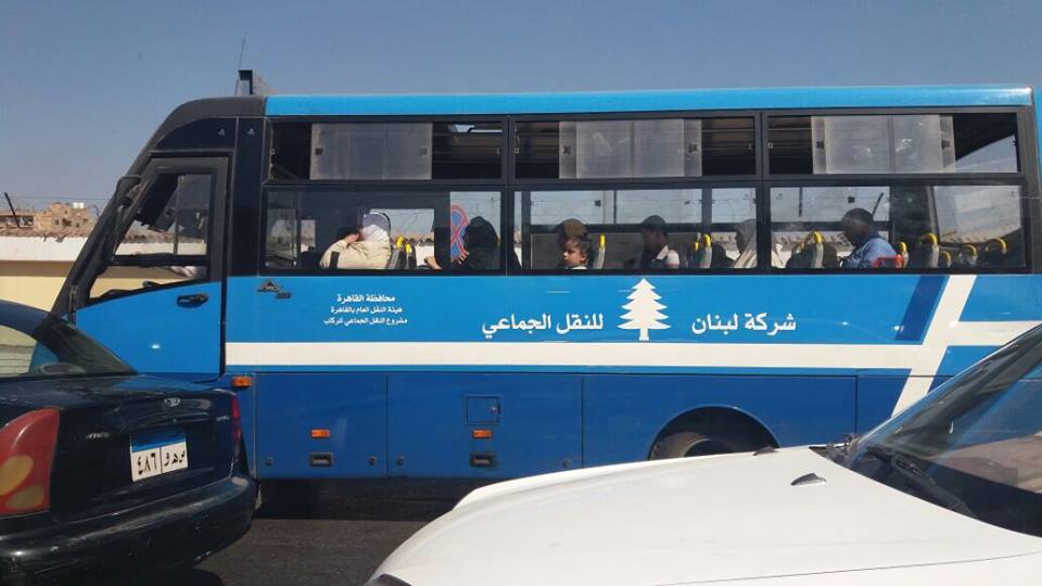
On February 27th, ELARD held a focus group with the general public in the Matn district, at the Saydeh Church hall in Sin el-Fil, as part of their ongoing Environmental and Social Impact Assessment study for the proposed BRT project that we blogged about previously. A good spectrum of views were voiced, and we were pleasantly surprised by the significant number of attendees who already use buses and services-taxis for the majority of their trips (in fact, only one young man admitted to “being a little annoying,” and using his car “for everything,” which was a brilliant way to put it).

We thought we’d pick up our coverage of the BRT conversation again with a brief summary and even briefer analysis of the views expressed in this session:

→ A man who served at the church and identified himself as a law graduate immediately voiced worries about the way the project design would mean “narrowing” the highway along the northern axis to accommodate a dedicated bus lane. He argued that, unless measures are taken to avoid increasing traffic for car drivers or at least prepare them beforehand through awareness and marketing campaigns to know what to expect, there will be an immediate backlash against the project. “This needs to work well from Day 1,” he insisted.

His comments were quite pertinent because they touched on a theme also discussed in an earlier focus group with transport unions (which we will post about in some detail soon): while the BRT project postulates an indirect theory of behavioral change based on speed, efficiency and rational choice — i.e. “when people see a bus running smoothly while they are stuck in traffic, they will think about taking the bus next time” — which seems reasonable on the surface, this comment and others like it point to an underappreciated emotional and maybe even moralistic dimension to this change as well. “People in Lebanon will not react positively to any change if they are not preconditioned through direct appeals to see their personal interest in this change,” he argued, echoing a similar point raised by one transit union representative about the project’s “image.”

→ A student who takes the Number 15 from Sin el Fil to AUB did not think the issue of awareness would be such a big deal, agreeing with the project designers’ hypothesis: the biggest argument for the project is its smooth functioning. She also added that billboards and advertisements could go a long way in preparing people for the change.

As for her existing transit use, the student said that even though the Number 15 is too slow, she prefers using it over having to deal with parking and traffic on her way to university. “When I’m forced to drive, I get angry,” she said. She also enjoys encountering her friends on the bus, as many take the same route. The only thing she doesn’t like about the bus is when they get crowded way beyond normal operating capacity. She likes the idea of having fixed bus stops along the BRT route, as this may reduce overcrowding as well as speed up the trip much more, as the slowness of existing transit tends to be due to all the arbitrary stops that drivers have to make to pick up passengers anywhere along the journey. One young man who came in late to the discussion jumped in at this point and argued that this overcrowding is also due to the incentives that drivers currently have to maximize profit by maximizing capacity: “if they become regular employees of the BRT operator, they won’t keep piling on people.” He also suggested that BRT buses would be designed to have people standing up, unlike the Mitsubishi Rosa models that we’re used to on our roads.

We wish more people who don’t take the bus in Lebanon would realize that overcrowding isn’t always due to there being too few buses on the road (though that is the case on some routes); there is a real demand for public transport right now, every day, meaning that anyone claiming that “Lebanese people will never take a bus” — yes, some people say this — is not basing their opinion on facts.

→ Another young man who goes to work to Ashrafieh by service-taxi, and occasionally takes the bus when heading to Batroun or Tripoli, was enthusiastic about the BRT project. The aspect that appealed to him most was its increased level of safety. He also mentioned how he hoped such a project would reduce the number of non-Lebanese transport workers in the sector.

A few comments in this vein, about “too many foreigners” driving buses, were made by others in this meeting, and in other discussions we’ve had with people about public transport. We think that such views need to be reconsidered, not just on humanitarian grounds, but also by realizing that the transit sector is always the easiest job market for migrants to enter, in any society. This can be seen in cities as diverse as New York and Melbourne, in countries where Lebanese people we know personally have worked as bus drivers and own taxi licenses like everyone else. The real issue in Lebanon, then, is not the identity of transport workers, but the unstructured way that non-Lebanese drivers have become integrated into the sector. This leaves everyone, including migrants, at a disadvantage. But let’s not forget as well that there is a war on our border, and the transport system’s receptiveness to new labor flows has been, in many ways, miraculous.

→ A middle aged lady expressed how much she likes existing buses “despite all their negatives.” Taking the bus puts her mind at ease, because she knows exactly where they go, unlike the less predictable routes of service-taxis. She mentioned taking a bus from Cola to Hasbaya, emphasizing how amazing it is to be able to go such distances with ease. “Why would I drive my car all the way there?” she asked. The aspect of the BRT project which she appreciated most was the punctuality of the bus scheduling that would be maintained.

→ A young woman who participated with her mother also agreed that she feels safer on the bus than in service-taxis. This is a common theme we hear from many women who use the bus regularly; buses tend to be seen as more public than taxis, leading to less harassment. She also added that she supports public transport because its better for the environment and personal budgeting than driving a car.

When asked what she thought the BRT project could add to improve personal safety even more, she said that video monitoring would help a lot to convince more women to consider the bus. The issue of women’s experiences of public transport is very important to us, and we will be publishing a series of posts on this subject very soon.

→ Interestingly, the sole car driver in the group claimed that even though he prefers his car, having taken a bus only once and losing his temper over its slowness, he might also be convinced to start taking public transport if the BRT project proved to be an effective alternative.

→ The final intervention came from a man who identified himself as a plumber and a Syrian who has lived in Sin el Fil for over 30 years. He argued that the new bus system should be run by the state, with existing operators hired by the state (ta3a2od), with social security and a fixed salary that would better their circumstances. It would be interesting to see whether transit unions would be open to such an idea, as their suggestions were more “free market”-oriented in scope (more on this in another post).

→ We asked whether any of the participants would have a problem walking ~500 meters to get to a bus stop, since the issue of bus user behavior was raised in a previous focus group as an obstacle to be surmounted, but the response in this session was unanimous: people are willing to walk to bus stops if this means increased safety for them. We wonder if this would be true for Beirut bus users as well.

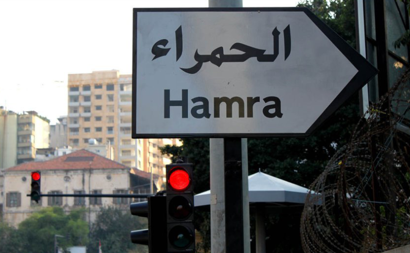
→ The last two points of discussion that stick out for us have to do with pricing and geographic integration: When we asked about the expected price of the BRT journey, since there has been some public talk of a 5000LL fare, we were told again that this issue is still being studied: should there be a flat rate or a sliding scale based on distance traveled? We asked participants how much they would be willing to pay for a trip to Hamra from where we were: 3000LL? Some said that this was reasonable, but the law graduate argued for a “fair usage system” that balanced between different social classes and the state’s need to recoup its investment in the project. We wonder what the World Bank’s loan for this project would stipulate in this regard, and whether a real balance can be found in a society with such a stark difference in classes. We tried to make this point during the meeting: that a great majority of existing bus users are migrant workers and retirees, for whom even a 500LL increase could make a significant impact – would the new BRT project create a two-tier system, with the most vulnerable forced to stay in the informally-run sector?

The second issue is equally thorny: the project design as it exists seems to cater too much to the coastal areas in and around Beirut, with suburban residents being left as an afterthought. Even this session, geared towards Matn, focused mostly on the areas closest to Beirut. The ongoing traffic chaos due to construction in Mkalles should raise a red flag about taking the traffic flow from the Upper Matn and surrounding regions too lightly. There are many educational institutions in this area, and morning traffic is a disaster on a regular basis, with far-reaching effects beyond the Matn. The only scenario being presented now, it seems, is: “people coming down from Bikfaya can park their cars [in Park and Ride facilities] when coming down to the coast” — but shouldn’t Park and Ride be encouraged further away from the coast? How many commuters would drive all the way from Bikfaya to the coast, going through all the traffic in that area, just to take a 10 minute bus ride into the city? The incentive to leave their cars at home should be planned for much earlier in the journey as a basic part of the BRT system itself. This is why, we insist again, that feeder buses from the regions surrounding the northern axis of Beirut must be planned for early on for this pilot project to effectively reduce traffic from Day 1; this cannot be left as an emergent possibility we hope will happen once the BRT system is up and running.

Since this project is ostensibly part of a much larger master plan, there is a real opportunity here for the Ministry of Public Works and Transport, the OCFTC and the CDR to work together with local municipalities and transit unions and operators in order to use the BRT project as a catalyst for mobility improvements across Greater Beirut and Mount Lebanon. The way this project is implemented can set the tone for all projects to be developed in the foreseeable future: will it be a form of urban acupuncture that frees up blocked energies and flows making even further improvements easier to attain, or will it be another bandage on a gaping wound?

Mapped! First Ten Routes

Here’s a sneak preview of our first, ten, mapped bus routes!

first10routesmapped-mar2015

We tracked these using LiveTrekker and Gaia GPS, and dumped them raw onto Google Maps. The routes will need to be cleaned up and labelled (and there’s a lot more coming!) but it’s fun to see the system start to take (some) shape and make (more) sense.

first10routesmapped-ii-mar2015

Live outside of Beirut? Want to help us track more bus routes? Yalla!

“Under The Bridge” by Nora Niasari

We’re excited to share this documentary by our friend Nora Niasari, now available to view online! Production of this short film on Beirut’s public transport began in 2010. In 2011, “Beirut, Under the Bridge” was awarded ‘Best Director Documentary’ and ‘Special Jury Prize Documentary’ at the 11th Beirut International Film Festival, and was broadcast on CNN and MTV Lebanon.

We asked Nora to reflect on her project, nearly six years on: “For me, Beirut is a city of unspoken potential. In 2010, our film stirred up a mostly dormant debate about public transport, asking why the sector was effectively buried alive after the civil war. We learned many things, but today, transport workers and transport users alike are still asking, “Where are we headed?”

Read more about Nora’s experience here.