#SpotTheBusMap!

It’s been a busy six months since we first launched our second edition Greater Beirut Bus & Van Map during Beirut Design Week; our team has grown, and our reach has spread. Have you spotted the map in the wild yet? After distributing it quietly in different cultural centers in Beirut, the team went out last Sunday to reconnect the map with its territory: the transit system itself! Big thanks to Alaa for all her help and summary below:

by Alaa Salam

It may have been a Sunday, but that didn’t deter the Bus Map Project team from taking some bus maps and heading out for work. Joining forces with the production team of Beirut Mini Maker Faire, we sat down for some map prepping. The aim was to hang up as many maps as possible on buses, from lines 2 and 12.

We moved out early, energized and prepared to take the challenge head on. We were met with an amazing, cooperative spirit from the bus drivers. In fact, some drivers came in and helped out! The head (“mas’oul”) of the bus lot even took 16 more maps to distribute amongst the remaining buses.

Afterwards, we took Bus Number 12 to Cola, where we took a van heading out to our next destination: Saida! 45mins and a couple of selfies later, the team reached the beautiful city. Encouraged by the great weather and welcoming bus drivers, we hung up an additional set of maps in Saida’s main van lot.

The Saida van lot drivers loved the Greater Beirut Bus Map so much that they inquired about the one for the South. We assured the drivers that the map is a work in progress — we will be working hard on getting it done! With their help, of course!

Feeling triumphant, we treated ourselves to some falafel and a boat ride around the islands. After such a successful day, we started heading back to Beirut, dreaming of bigger campaigns. But while on the road, we were surprised my messages from some of the drivers we’d met on line 2 and 12.

They were sending us photos of themselves with the map! Each of the drivers had taken a copy and expertly set it up in his vehicle — then posed with it! The drivers also expressed their deep gratitude to the team and congratulated them on such a wonderful effort. This was the biggest pat on the back the team could have received.

All in all, Sunday was a day to remember by both teams. But the real treat here is: can you #SpotTheBusMap? Stay tuned for additional news and a couple of surprises! From all the members of Bus Map Project, we wish you always have a great bus ride!

From City to Studio and Back: Design as Civic Action

To what extent is it appropriate to formally map an informal system? Can collective mapping help spark new ways of thinking about public transit in Lebanon? These are some of the questions raised by Bus Map Project’s participation in Beirut Design Week this year, when we launched our second prototype bus map of Greater Beirut and the alpha version of our online transit platform BusMap.me, a participative tool that seeks to crowdsource, clarify and spread information about the people, places, voices and traces of Lebanon’s transit system. Will you join us on board?

By Mira Tfaily and Jad Baaklini


June 23, 2018. Photo by Moussa Shabandar


Slow-Hacking Beirut’s Bus Map

Beyond the brute fact of mapping, Bus Map Project has always been driven by a desire to disrupt the traditional talking-points around public transport in Lebanon. Our project is patient and incremental because it insists on a fresh perspective on urban change. By making visible the range and regularities of our ubiquitous yet little-understood transit system, our map is trying to prove a point; it is advocacy by other means. And what it demands is that we start taking this transit system more seriously.

Yet, in doing so, the bus map tends to hog the spotlight as an artifact — a solid, already-accomplished matter of fact — pushing these motivating questions into the background, like any utilitarian tool eventually does. How, then, can we (re)turn the map, from an object of design, back to a matter of concern and a locus for civic action? How do we keep its point — its advocacy by other means — at the forefront?

More importantly, how do we keep this traffic flowing both ways? From tool to platform and back again, how do we break the silos between expertise and experience (design and ridership) to widen the sense of shared ownership to encompass as many civic actors as possible?

As part of Beirut Design Week, and in partnership with Public Works Studio through their Forum on Cities and Designers, Bus Map Project had the incredible opportunity to organize a workshop on June 23th, 2018, entitled “Slow-Hacking Beirut’s Bus Map.” The idea of “Slow-Hacking” — coined at first in jest by Public Works’ Monica Basbous — came out of our concern for making sure that this map that we’ve been lovingly piecing together, route-by-route, for a while, remains an open question: open to change in itself, and open by catalyzing debate over the cities we live in and reproduce every day. The word is meant to appropriate the can-do attitude of hackathons — that helpful sense of agency and confidence that we want to see more of in urban advocacy in Lebanon — while rejecting the less helpful sense of misguided urgency and false efficacy behind the fantasy of quick fixes.

Over the course of three hours, we attempted to prefigure the slogan recently displayed on the state’s own buses (“shared transport is a shared responsibility”), while inviting participants into our process. Through an interactive presentation, we shared Bus Map Project’s view of mapping as a form of activism — the kind that not only pushes for recognition of the existing system of transport now marginalized within the dominant doxa, but that also stirs up conversations about the mobile inequalities that traverse it.

We tried to keep our presentation anchored in ourselves, as riders and advocates. We shared the context of our own meandering journeys into the project: Chadi’s early development work in 2008, Jad’s research and activism interests in 2010, Sergej’s work with Zawarib in 2012, and Mira’s journalistic introduction to our work in 2016 before joining as a researcher in 2017. From this personal and collective perspective, a lot has changed since the seed was first planted when someone once said that creating a bus map for Lebanon was one step too far (because a map would legitimize something ‘substandard’). Today, very few people will argue that public transport doesn’t exist in Lebanon — the lacuna where it all began.

From that point of view, much of our work is done; thank you for tagging along, and we hope that by foregrounding the ordinary ways that our personal stories became entangled in the politics of this often-mystified thing called the city, this small project can serve as a case study that inspires you and others to adopt similarly incremental approaches to seemingly intractable problems.

From a wider perspective, however, our work has only just begun. And we need your help to keep moving forward.

Photo by Chadi Faraj


Whose Streets? Our Streets

The workshop participants came from diverse backgrounds (architects, GIS specialists, urban planners, graphic designers, etc.) but shared overlapping interests. We opened the session by asking everyone to share their understandings of, and experiences with, Lebanon’s buses. Some came to the event with a lot of experience riding transit; others were curious and wanted to learn more. Some had initiatives of their own, like a WhatsApp group to share information with newcomers on how to get around Lebanon by public transport and a “mobility transformation” Meetup.

This personal approach helped us keep the discussion rooted in the city as a lived experience, far from the technical abstractions that create artificial and disempowering distance between our reality as ordinary practitioners and the infrastructures we help reproduce every day.

To emphasize this idea, our presentation of the basic features of Lebanon’s transit system turned the usual definition of public transport on its head: instead of starting at ‘the top,’ drawing conceptual contours and differentiating ‘para-‘ from ‘-transit’ proper, we privileged the concrete reality of riders first: their flesh-and-blood facticity, their cosmopolitan diversity, their eyes looking directly into yours, demanding recognition and ‘equal access’ to visibility.

When we put things in this way, we swerve very close to romanticism. That’s fine. This is because the simple profundity of the person is the foundation of everything we do. From this understanding, we define public transport as first and foremost a transport public. From that, we branch out and begin to notice the spaces of conviviality that connect user to operator, bus to system, street to map. On this foundation, we clarify our shared stakes in combatting misinformation and stigma (that perennial problem that we mustn’t underestimate) and keeping transit advocacy rooted in real lives and livelihoods. Only then do we dare to offer definitions.

Lebanon’s transit system is best understood as a network of networks, gelling together along several spectra of agglomeration and ownership:

  • state-owned (OCFTC) ↔ municipally-owned (Ghosta, Dekwene) or organized (Bourj Hammoud)
  • corporate (Connexion, LCC, LTC/Zantout…) ↔ family businesses (Ahdab, Sakr, Estephan…)
  • route associations or fleets of a few owners with shared management (Number 2, Number 5, Van 4…) ↔ loose networks of individual operators (Number 22, Bekaa Vans…)

When our discussion turned to these concepts, a lot of debate was sparked, including a conversation on the controversial BRT system that we’ve blogged extensibly about. Hence, one consequence of taking the existing system seriously — people first, places second, conceptual categories last — is making the question of working with what exists (joud bel mawjoud) much more realistic and pressing. Why can’t we invest in existing people?

Connecting the Map to the City

After the presentation, everybody was invited to pitch in and make our map their own: What would they add? How would they represent informal landmarks? What changes would they propose to make the map more accessible?

Many participants thought that the Number 5 and Number 2 bus were the same, when the two lines separate at Sassine heading north. Misapprehensions like this point to the importance of involving more and more people from ever-wider circles in this collective project; indeed, the majority of us agreed that collective and incremental design can be a powerful language and tool for encouraging a change of mentality needed to shift our society towards more sustainable and just mobilities. June 23 was Day 1 of hopefully many more in this new phase in our project, and we will continually look for more ways to involve as many people as possible in the making and hacking of our collective output.

One tool we hope will facilitate this is our online participative platform (BusMap.me), launched during the workshop. It’s still in alpha development, but we’re so happy to finally make it public — a big thank you goes out to Chadi and our grassroots mappers for their hard work! BusMap.me aims to become a hub for crowdsourcing GPS data and annotating Lebanon’s transit routes with photos, tips and stories — material that can’t fit into a single, static bus map, but which is pretty much the essence of mapping our word-of-mouth urban geography, Lebanese-style.

The platform is imperfect and incomplete by design — and we mean it when we say that this is by design; we refuse to wear the crown of authority over this endeavor and proudly wave the banner of engaged amateurism in the city, with stubborn determination — because beyond mapping, the platform is meant to be an invitation for people to engage with shaping the system, contributing what they can to a collectively-owned map that celebrates the cacophony of voices that constitute Lebanon’s transit system. Think you can do better? Get in touch!

Our involvement in the Beirut Design Week continued on June 26th, 2018, when Sergej presented our work and his design process during a roundtable organized by Public Works entitled “Between City and Studio: Connecting the Map to the City”. Building on the previous participative workshop, he emphasized the activist role of the mapper and map designer. Every map is a collection of choices — deciding how and what to display influences the collective imageries and tropes that either challenge the established urban mythology, or, on the contrary, contribute to furthering the gap between urbanist discourse and lived reality. Mapping is and should remain an open question and we hope that more and more people recognize and join this political process that we are catalyzing.

Later that week, some encouraging signs of this happening emerged! We had the pleasure of attending YallaBus’s first meet and greet, where they facilitated their own participative discussion to debate the mapping of Lebanese bus routes, and presented the first version of their transit app. Taking inspiration from our work and building on our second prototype, YallaBus has started working on their own static map; during the event, attendees also came up with new and exciting solutions to face the challenges of mapping and visualizing an informal system.

We also took the opportunity to raise some questions about YallaBus’s release of the live GPS feed of Number 2 in Beirut. While we are excited to see progress in this live-tracking work, this beta release poses privacy and security concerns, since the location of buses (and, presumably, the homes of bus drivers) in the initial release was on display, potentially endangering the drivers. We are happy that YallaBus has been open to such feedback and look forward to seeing how their app develops.

We are also enthusiastic to see more events and gatherings of this type happening in the future. Let us keep catalyzing the change we want to see! Proactively, pragmatically, sometime’s poetically — our cities are ours for the (re-)taking.

Learning to Use Lebanese Buses, One Trip at a Time—a #RiderStory

by Jad Baaklini and Mira Tfaily

Lack of information is the main obstacle stopping many people from using public transport in Lebanon. This issue, and the fact that this gap in public knowledge has too often been filled with simplistic myth or exaggerated legend, is the raison d’être of our project.

But overcoming this obstacle, in our view, is not just a matter of taking on the role of the cartographic “Godot” we’ve been waiting for; Bus Map Project has been and still is stubbornly insistent on pushing the problematic beyond the quick-fix mentality: if you’re interested in riding the bus in Lebanon, you can either choose to remain an outsider, or you can take a leap of faith and engage with the system to learn about it first-hand, route by route, journey by journey, contributing to a collective map that isn’t dropped from the sky, but rather, has been laboriously tended to, and is chock-full of living history.

Today’s #RiderStory introduces Clément, a French hiker who shares our zeal, and who has taken it upon himself to figure out the system at its very fringes. Building up a library of experiential knowledge, Clément has been sharing his discoveries and tricks on his hiking website, as well as contributing to our collective mapping process. In this post, we reflect on his learning as a way of better expressing our own.

*

« The Lebanese bus system can seem difficult to access for neophytes, but once you start asking people on the ground, it can be figured out smoothly and little by little. My first time in Dora as a foreigner was quite an experience, but now I get around very easily there, » Clément explains. His first experience taking the bus was on a well-known route, the very busy Dora-Byblos line. He then started exploring lesser-known routes, learning about the system empirically and piecing together the bigger picture route by route. « I was surprised by how little information there is on public transport in Lebanon. One good way of seeing if the system is understandable to outsiders is to see whether foreigners are able to access it or not. I noted that the routes going from Cola to the South and Dora to Tripoli are indeed used by foreigners -– who hear of them by word-of-mouth -– but the rest of the routes are pretty much used only by locals who need the buses to reach their villages or workplaces. »

Clément’s reflections bring up a very interesting “epistemology” or theory of knowledge for a city like Beirut. We often say that our project attempts to make Beirut “more legible,” which is a word that evokes a very visual, or even textual, way of engaging with the city. It’s the kind of engagement described in Kevin Lynch’s “The Image of the City”, a classic in the urban literature. In it, Lynch talks about the « highly imageable (apparent, legible, or visible) city [as] well formed, distinct, remarkable; it would invite the eye and the ear to greater attention and participation…Such a city would be one that could be apprehended over time as a pattern of high continuity with many distinctive parts clearly inter-connected. » We hesitate to try and analyze Beirut by this definition; at the very least, we’d double and triple underline the “over time” part of that sentence. Instead, Clément’s observation of how Beirut’s transit system is gradually apprehended by outsiders through word-of-mouth is an important reminder of the fact that visual representations of a city — like mapping — will miss a lot about how a city like Beirut actually functions. Even Lynch admits that there are other properties in “beautiful environments,” like « meaning or expressiveness, sensuous delight, rhythm, stimulus, choice » — these are aspects of urban life that are too easily sacrificed when the issue of public transport is reduced to a problem of “lack.” As Jenny Gustafsson once wrote in a popular article on ‘mapping Beirut-style,’ « Maps, when functioning well, become an extension of our knowledge » — to which, we add the important caveat: maps can also easily become dysfunctional if they crowd out or colonize other ways of knowing.

Clément’s empirical discoveries allowed him to develop tricks to make the most of the system, and speak in the urban vocabulary and grammar more fluently: « In Dora for example, it is better to stand further from the bus stop and hop on a bus that is already on its way, rather than waiting at the bus stop for a bus to fill up and go. » Another clever strategy is to take a van rather than a bus when going to a far-away place like Tripoli: they fill up more rapidly than buses and hence will go straight to the final destination without stopping every few kilometers to pick up clients. What map can teach you that? Quoting from Jenny’s article again, it is important that transit solutions in the Middle East take seriously the way that MENA cities are actually put together: « It’s about learning how a city works. There’s usually a very clear order; you just have to understand it. »

20170728_142853

After getting in touch with us, Clément started volunteering his time for Bus Map Project exploring new and obscure routes, tracking the Cola-Niha line for example, among others. « I think it is a challenge to map the informal system because here people are used to orienting themselves differently, with landmarks rather than streets for example. The only map I was able to find was the Zawarib one for Beirut buses. However, I found it quite difficult to use; it looked like a metro map and some routes were outdated, » he explained. The predominance of the metro-style or “Tube map” is not just a matter of aesthetics; it is a deliberate choice to represent the city in a very particular way, one that sacrifices much too much cultural nuance for the sake of supposed clarity and visual appeal. One of our friends who produced a transit map in another city in the region once lamented to us how little their highly-schematic map was being used by the general public, saying that « people here aren’t used to reading maps » — we’d turn that problem on its head, and say, instead, that people here aren’t used to valuing how people here actually are (think, live, and get around). Mapping MENA-style is indeed a very real but worthwhile challenge.

Among Clément’s repertoire of urban tactics was learning to avoid congestion by deftly choosing internal versus external routes to get around faster; for example, hopping on the external Bikfaya-Dora line to get from Sin-el-Fil to Dora. These are tricks that can only be learned over time. « Lebanese people are often surprised when I explain that I take the bus; I’m guessing the lack of information available contributes to unnecessary stigmas such as danger or violence, which is very far from the truth, » he reflected. We’d add that the lack of information is also an opportunity to contribute more intentionally to the city-making we are always already part of — Clément’s tips and tricks are urbanism, no less important for shaping the city than any engineering blueprint or national land transport strategy.

Clément's watch, that he uses to track the bus routes
Clément’s watch, that he uses to track the bus routes

Sensing that he is contributing to something larger than himself, Clément started a hiking website to share his transit discoveries. « I am a hiker and I wanted to explore Lebanon by myself, but I quickly figured out that all hiking websites took it as a prerequisite to have a car to get to the trails. So I started tracking the bus routes I would take using my watch and uploading them on my website. » By documenting his experiences with routes, precise information and pictures, he encourages and equips wanderers of all kinds to experience Lebanon differently. « I am just sharing the information I would have liked to have had when I arrived here in January. The website of the Lebanon Mountain Trail is very complete but does not display any information on how to get to the trails by public transport. The travel agency Living Lebanon gathers some useful routes, but not all of them; it’s the same for the WikiLoc portal. » While a lot of hikers in Lebanon go on organized group tours where everything is taken care of, Clément’s sharing of information is an invitation to explore, learn and document more individually and freely. And in doing so, helps us connect the dots between two engaged, but previously-disconnected communities that #LiveLoveLebanon in the city and beyond.

Are you a transit rider? Do you want to contribute to our project? Email us at hello [at] busmap [dot] me

Has the Existing Transit System in Lebanon Finally Been Recognized? / هل بدأنا اخيرا بالاعتراف بوجود نظام نقل شعبي و غير رسمي بعد ان كانت حتى النقاشات لا تذكره ولا تعبره؟

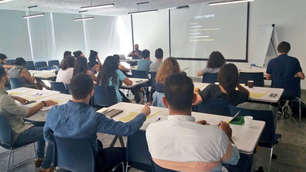
On October 25th and 26th, we had the pleasure and honor of being invited by Dr Tammam Nakkash to a symposium organized at the Order of Engineers and Architects called “Towards Organized Public Transport in Lebanon.”

في ٢٥ ت١ ٢٦ ت١ ٢٠١٧ ، لقد كان  لنا الشرف بتلبية دعوة من قبل الدكتور تمام نقاش للمشاركة في سيمبوزيوم في نقابة الهندسة في بيروت بعنوان ” نحو نقل عام منظم”.

We were first introduced to Dr Nakkash almost seven years ago, as a keynote speaker in an event called “Public Transportation, Public Concern,” where he lectured on all the necessary, institutional prerequisites to transport sector reform in Lebanon. The message he clearly articulated that day in December was that there were no apolitical quick-fixes to introducing new transport modes in the country, and in doing so — in calling for real “champions” of public transport — Dr Nakkash helped plant the seed for what eventually became the Bus Map Project in 2015. So for that alone, we are thankful for his interest in our work today.

كنا قد تعرفنا الى دكتور نقاش منذ حوالي السبع سنوات كمحاور رئيسي في مؤتمر “النقل العام شأن عام” حيث حاور بكل الحاجات الاساسية من قوانين واجراءات لاعادة الاعتبار للقطاع النقل واعادة تنظيمه. وقد اعلن بشكل واضح ان لا حلول سياسية سريعة –.
فبهذا، ومن خلال دعوته الشبابية ل “الأبطال”  في احياء القطاع، يكون الدكتور نقاش زرع البذور الاولى لما اصبح يعرف بمشروع خريطة الباص في ال ٢٠١٥. لذلك نشكر اهتمامه في مشروعنا اليوم.

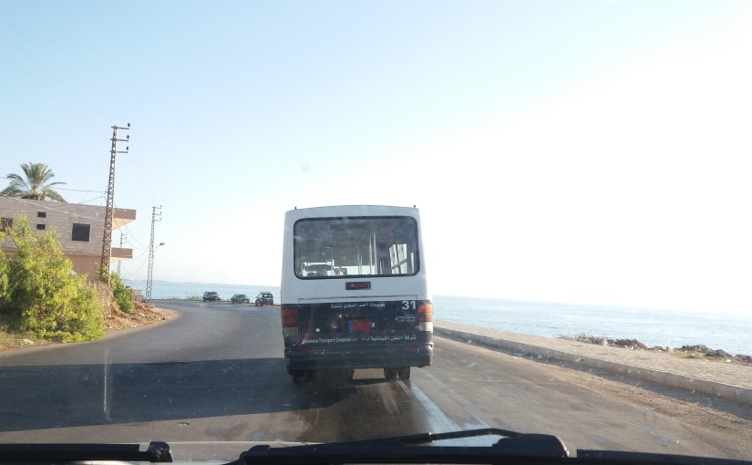
The other important detail we remember from that day in Masrah el-Madina was a question posed by the only politician in attendance, MP Ghassan Moukheiber, who, after listening to the problems of congestion in Beirut and the bright visions of Bogota, politely yet firmly asked to hear more about the existing transit situation in Lebanon. The panelists had very little to say. One speaker admitted she had taken a bus in Beirut only once in her life, having vowed to never repeat it, because it was too slow.

الشيء الاخر الذي يجب ذكره عندما نراجع ذكرياتنا في مسرح المدينة هو سؤال من قبل السياسي الوحيد الذي كان حاضرا، النائب مخيبر، عن نظام النقل الموجود فعليا الان في لبنان، وذلك بعد استماعه لمشاكل زحمة السير والحل الذي حصل في بوغوتا وغيرها من المدن النموذجية. فالمحارون كان لديهم القليل ليقلوه حتى احد المحاورات قد اعترفت انها اخذت الباص مرة واحدة فقط في بيروت طوال حياتها وانها لن تعيدها مرة اخرى بسبب بطئ الباص.

Fast forward to 2017. The two-day event at the OEA began with a recurring leitmotiv that made us feel that plus ça change in the way that the “public concern” of public transport was conceived. “Detailed and updated plans to implement change in Lebanon have been studied for over 10 years,” we heard again and again, “but what has been failing dramatically is the enforcement and implementation.” From there, the different panelists and discussants focussed on the different ways to break through this institutional barrier of policy immobilism. Dr Nakkash’s presentation dove into more details about the causes of the status quo of stasis in Lebanon. Suggesting concrete solutions to address some very specific issues (e.g. architects and engineers who participated in the construction of buildings on lands owned by the OCFTC should be invistigated), he also highlighted one of the main problems of transit in Lebanon: the tie between transport funding and the government, that makes any plan correlated to possible institutional instability and lack of political will. This was one of the same prerequisites he had spoken about in 2010.

فلنعود الى ال ٢٠١٧ والى النهارين في نقابة الهندسة اللذان اعطا انطباع الى اعادة الاهتمام الى قطاع النقل من قبل المجتمع عامة والمهندسين والمختاصين خاصة. اكثر من عشرة سنوات ونسمع ان هنالك دراسات وخطط ومخططات للقطاع تدرس تعدل ولا تطبق. من هنا حاول المحاورون شرح ومناقشة السياسات التى جمدت هذا القطاع والعقبات التي وقفت في تطوره.

محاضرة الدكتور نقاش حاولت الغوص في تفاصيل هذا الوضع مقترحا حلول عملية لمواجهة بعض المشاكل (كأقتراح العمل على سحب تراخيص المهندسين الذين شاركوا في التعدي على املاك مصلحة الحديد والنقل المشترك). وشدد على مشكلة من المشاكل الاساسية للقطاع النقل في لبنان وهي الربط بين ميزانيات النقل والحكومة التي تعاني من عدم الاستقرار وعدم ايجاد الارادة السياسية لتطوير القطاع .وهذا ما كان صرحه في محاضرته في ال ٢٠١٠.

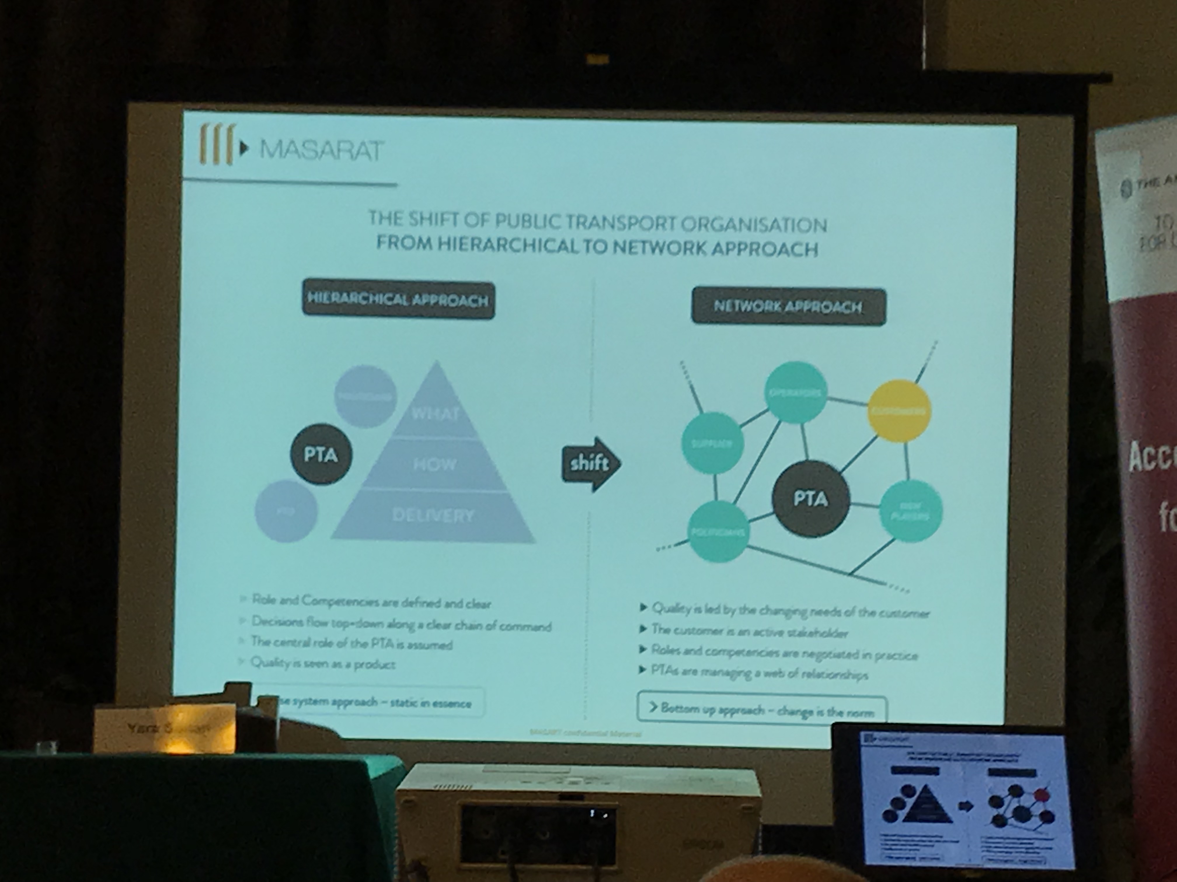
Nakkash elucidated how he had been suggesting for years a simple solution to the imbroglio of overlapping responsibilities between the OCFTC, the Ministry of Public Works and Transport and the municipalities: the creation of a higher, centralized transit authority that would bypass the frustrations and disentangle the bureaucratic knots by having its own fund, separated from the government’s budget, which only conspires to suffocate projects at birth. One example he gave was the rejection of the BRT plans by the Municipality of Beirut: in his view, the presence of an independent transit authority would bring consistency to transit strategies.

نقاش صرح واعلن كم يعاني لسنوات من تضارب الصلاحيات بين الادارات والوزارات ومصلحة السكك الحديد والنقل المشترك والبلديات المسؤولة عن القطاع، وانه منذ زمن طالب بأنشاء هيئة مستقلة مسؤولة للنقل لديها كل الصلاحيات لتكسر البيروقراطية الموجودة وتتمتع بأستقلال مالي تستطيع من خلاله  تمويل طول  مدة مراحل المشروع، من التخطيط الى التنفيذ الادارة اليومية حتى لا تموت المشاريع في مهدها كما يحصل الان. واحد الامثلة الذي اعطاها رفض مشروع الباص السريع من قبل بلدية بيروت ومن وجهة نظره وجود الهئية المستقلة للنقل سيعطي قوة وتكامل لخطط واستراتجيات النقل.

LRT in Saida

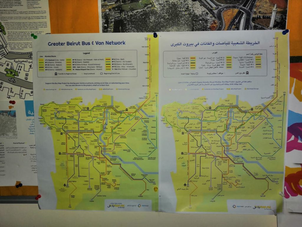
While it was inspiring to see Dr. Nakkash’s tireless fight to save policymakers from themselves, the issue that was most pertinent from our perspective was his challenge to the mainstream definition of public transport that we often hear in casual and even activist conversations: “Public/Shared transport is not defined by the entity who owns it and operates it.” Rather, Nakkash argued that public transport is characterized by fixed routes, fixed stops, fixed schedules, and access for everybody in exchange for a fee. While this definition of public transport may seem to exclude Beirut’s existing transit at first glance, it certainly opens up much more room for understanding how this system fills many gaps — and hence, meets most criteria — of more formal systems.

ورغم كل الجهد الذي صرفه الدكتور نقاش في المؤتمر لمحاولة تبيان العجز السياسي والتنظيمي في منظومة النقل، الا اننا يهمنا بشكل خاص اظهار تعريف النقل المشترك او العام او العمومي حسب ما عرفه دكتور نقاش والذي لطالما كان موضوع جدل بين الناشطين في القطاع.

فعرفه بأن النقل العام او المشترك او العمومي و هو نقل لا يهم صفة ملكيته او تشغيله، اهو قطاع عام او خاص، انما هو النقل على خطوط ثابتة محددة مسبقا يتم الصعود والنزول في محطات محددة ويعمل حسب جداول و توقيتات معلنة واستعماله متاح للجميع الراغبين يشتركون مع غيرهم مقابل بدل مادي. وهذا التعريف لا يستبعد النظام الغير رسمي المستعمل في بيروت بشكل كامل، بل يفتح المجال امام فهم كيفية عمل هذا النظام وملئ النقص والحاجات للناس ولديه الكثير من النقاط والايجابيات

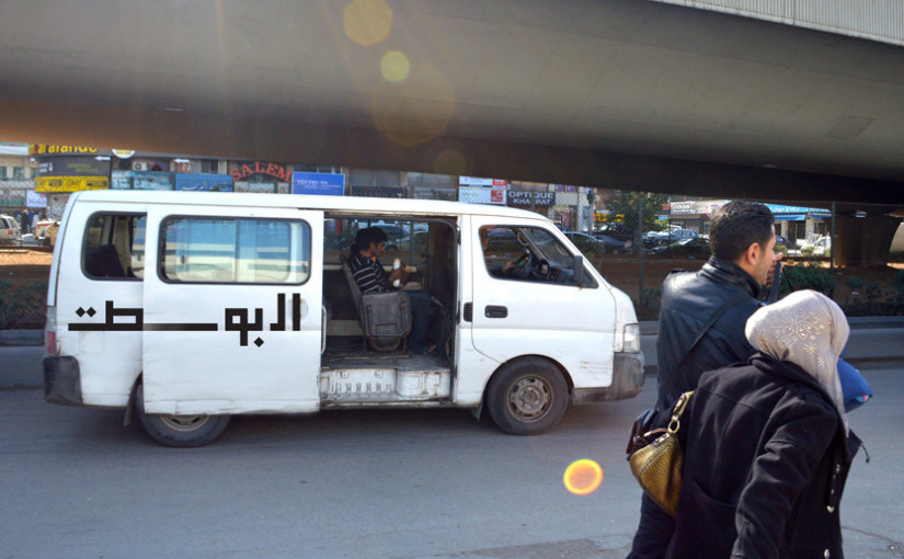
Using the example of the Van Number 4, which takes advantage of the unregulated environment to reach a dynamism that formal transport could never compete with, Nakkash called for the formalization of the line to a certain extent, and hence, acknowledged the need for planning for integration, and not exclusion.

إستناداً على مثال الفان رقم ٤ الذي استفاد من عدم وجود بيئة تنظيمة للقطاع والذي وصل الى دينامكية لا تستطيع الانظمة الرسمية التنافس معه فيها، دكتور نقاش طلب بأيجاد اطر تنظيمية لهذا الخط، والتوجه نحو الدمج وليس نحو العزل.

الاشخاص الذين يعملون على موضوع النقل المشترك في لبنان يجب ان يتعاملوا مع قطاع النقل الغير رسمي وكذلك في العالم اذ انها جزء من التحديات التي تؤثر على القطاع النقل والتنقل.

The people whose job it is to plan public transport in the MENA region and in Lebanon have to address the question of informality, as well as global challenges that affect transit and mobility everywhere. This is what Dr Ayman Smadi, former Director of Traffic and Transport at the Greater Amman Municipality and current Director of the MENA branch of the UITP, emphasized in his keynote speech. One of these challenges is the penetration of private companies like Uber or Careem in the transit market, a phenomenon that is more striking in a country like Lebanon, where transit is almost wholly run by private operators due to endemic state neglect. To what extent is it possible to create a holistic, national land transport strategy that integrates all the stakeholders from the public and the private sectors? The acknowledgement of the existing system is an obvious prerequisite, as well as a state vision that is transparent and which is as concerned with addressing sociocultural attitudes as it is on built infrastructure.

هذا ما تحدث به الدكتور ايمن الصمدي المدير السابق للنقل والسير في مدينة عمان والمدير العام للمتوسط في الاتحاد الدولي للنقل العام واكد عليه في مشاركته. واحد هذه التحديات دخول شركات الخاصة الى القطاع وخاصة اوبر وكريم وتأثيرها على القطاع خصوصا في لبنان حيث القطاع الخاص لديه اليد الطولة في تسيير الخدمات في ظل غياب الدولة.الى مدى نستطيع خلق خطة واستراتجية ناجحة تجمع كل الاعبين المساهمين في القطاع من القطاعين العام او الخاص؟ الاعتراف بالنظام الموجود هو خطوة مطلوبة واساسية كما رؤية الدولة مع الشفافية التي تواجه وتعالج االمشاكل الثقافية والاجتماعية لبناء البنى التحتية للقطاع.

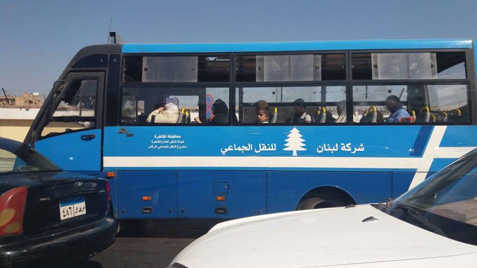
Even though most panelists still saw our bostas, vans and minibuses as a temporary gap-filler that should be replaced, the fact of even acknowledging their existence in a setting like this was an important step forward towards integration. While seeing them as insufficient, Jad Tabet, presiding head of the OEA, listed these modes in the options available for citizens who want to get around the country: “There isn’t in Lebanon any choice for mobility except private cars, services, buses, vans.” Ramzi Salameh from the Road Safety Authority even took it one step further, encouraging the use of the actual existing system whenever possible.

جاد تابت نقيب المهندسين في بيروت صرح انه لا يوجد وسائل متاحة الان للاستعمال الا السيارة الخاصة,التاكسي والسرفيس والباصات والفانات وطلب بوجود انماط اخرى فعالة للنقل والتنقل .
وايضا هناك البعض من المتكلمين كانت ارائهم تتمحور حول قضية ايجاد بديل للنظام الباصات والفانات الموجودة الا ان ذلك نعتبره اعتراف بوجودهم وانهم يملؤون فراغ الموجود في القطاع بتقديم خدمات النقل وهذا اعتراف هام للدمج في المراحل اللاحقة.

As we pointed out in our presentation during the last panel, physical infrastructures and technologies alone are not sufficient for implementing sustainable change. This was further emphasized by Wissam al Tawil, president of the Scientific Committee of the OEA, who said that policies only oriented towards improving infrastructures are doomed to fail. The issue of transport in the country is not only technical, but cultural. The omnipresence of car culture was widely debated by MP Mohammad Qabbani, who is a member of the parliamentary workgroup on transport issues. Dr Christine Mady from NDU broke down the definition of infrastructure even further, dividing it into four categories: physical, social, institutional, and information/technological. Hence, a holistic shift in all levels is needed to re-orient urban development towards transit use.

” ليس في لبنان حالياً خيارات أخرى غير السيارات الخاصة سوى سيارات الأجرة والفانات والباصات، ولا يوجد اليوم خطة متكاملة لتنظيم وسائل التنقل هذه تسمح بالحدّ من الفوضى وباحترام معايير السلامة العامة”.
رمزي سلامة امين عام السلامة المرورية اخذ الموضوع الى بعد اخر بأستعمال النظام الموجود والعمل على تحسينه.

كم ذكرنا في مشاركتنا في المؤتمر البنى التحتية المادية والتكنولوجيا لا تكفي لتغيير مستدام وهذا ما اوضحه واكده رئيس اللجنة العلمية لنقابة الهندسة وسام الطويل، الذي قال: السياسات التي تتبع مسار تحسين البنى التحتية المادية هي تفشل دائما ولا يتخيل احد ان حل مشكلة النقل تكون بتوسيع طريق او مد جسور. والمشكلة في موضوع النقل ليست فقط تقنية انما ثقافية. هذا ما اوضحه رئيس لجنة الاشغال والنقل محمد قباني. الدكتورة كريستين ماضي من جامعة اللويزة فصلت البنى التحتية الى اربع اقسام: مادية،اجتماعية، تنظيمية، وتكنولوجية ودعت الى التحول الى التخطيط العمراني على شكل التنمية نحو العبور transit oriented development الذي يؤدي الى شعور الانتماء للمجتمع ويسهل الولوج الى الخدمات العامة.

In conclusion, we reiterate that the problem of (im)mobility in Lebanon cannot be solved through a set of top-down policies that keep ignoring the existing transit system and the daily livelihoods and reality of thousands of riders and workers that it represents. The OEA symposium has brought to the fore the obstacles preventing the implementation of a national transport strategy; but shouldn’t the first step for change be the use of the available and functioning transit system of the country?

في الخلاصة نكرر ان مشكلة النقل والتنقل لا يمكن حلها بسياسات تغيير فوقية تتجاهل النظام الموجود وحياة واقع الكثير من الركاب والسائقين العاملين في هذا القطاع، والذين لهم الحق في ابداء رأيهم ويكونو شركاء في القررات. وقد ابرزت الندوة في نقابة الهندسة العقبات التي تحول دون وجود استراتجية وطنية للنقل؛ لكن الا يجب ان تكون اولى الخطوات لها استعمال نظام النقل الموجود الفعال في البلاد؟

Dr Mona Fawaz from AUB closed the symposium on this note, with these very encouraging final words: “Decision makers need to be convinced by the culture of public transport. The main point that came out of these two days is that there indeed is an existing system and we need to use it when we can, because this is the first step towards change.”

الدكتورة منى فواز من الجامعة الاميركية لخصت السيمبوزيوم بهذه العبارات المشجعة: “المسؤولين يجب ان يقتنعوا بثقافة النقل المشترك. والنقطة المهمة بعد هذين النهارين هناك نظام موجود وندعو الى استعماله عندما نستطيع لانه هذه اولى الخطوات للتغيير”.

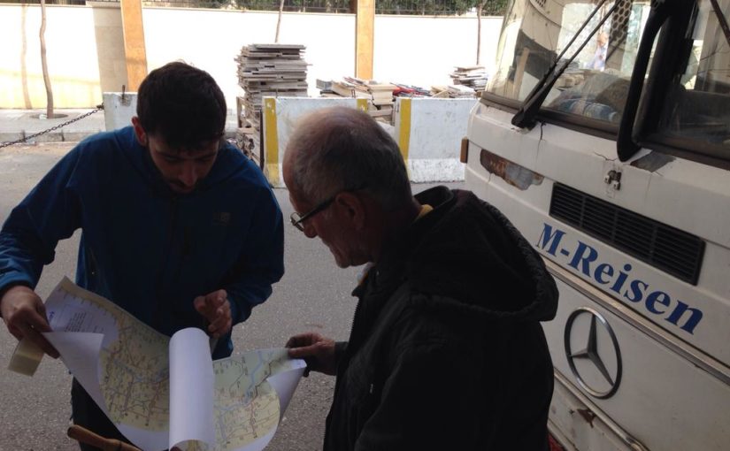
We hope to see more of Beirut’s transit champions riding the bus with the likes of us in the near future.

نأمل أن نرى المزيد من الأبطال في بيروت الذين يركبون الحافلة مع أمثالنا في المستقبل القريب


Symposium report prepared by Mira Tfaily, Chadi Faraj and Jad Baaklini

“Our transport is mirroring our society”—Reflections on the “Amman, Beirut, Cairo” Regional Exchange

by Mira Tfaily

Last week, five of us from the Bus Map Project team (Chadi, Jad, Mira, Haifa and Sergej) had the pleasure of participating in a Regional Exchange conference organized by FES Cairo and A2K4D around the question of transit and mobility in the MENA region. The conference brought together grassroots mapping initiatives and various stakeholders from the engineering, advocacy and research worlds from the MENA and beyond, to spark conversations, explore synergies, and engage in new creative thinking about how to work with the infrastructures and ‘infostructures‘ we find ourselves in. Though we had different perspectives and experiences, our shared aim was “making a shift from car-oriented cities to people-oriented cities” across the region. In this post, Mira reflects on some of the interesting points of convergence and tension that came up during the conference:

an unexpected encounter in the streets of Cairo
“The Lebanon Company for Mass Transit” — an unexpected encounter in the streets of Cairo

“A developed city is not where the poor have cars, it is where the rich use public transportation” — these words by Gustavo Petro opened the conference hosted by the American University in Cairo, in the iconic Oriental Hall of the historic Tahrir Square campus. The two days of discussion linked up stakeholders across the pro-transit spectrum. Panels included Dr Ayman Smadi, former Director of Traffic and Transport at the Greater Amman Municipality and current Director of the MENA branch of the UITP, and five transit mapping initiatives, big and small: Transport for Cairo, (Egypt) Ma’an Nassel (Jordan), Digital Matatus (Kenya), WhereIsMyTransport (South Africa/UK), and of course, our humble Bus Map Project representing Lebanon.

Much to our enthusiasm, actors from such different perspectives seemed to have reached very similar conclusions: to tackle mobility issues in cities where there are large gaps in transit provision, the most effective way for encouraging new patterns is to rethink our old, top-down planning tropes.

IMG_2725

As Dr Ahmed Mosa from MASARAT put it, a crucial shift is needed in public transport organization from a hierarchical to a network approach. This surprising language from an engineer and planner helped us see that there are openings for grassroots mapping initiatives like ours to enter the policymaking conversation. Our bus riders’ perspective becomes a policy instrument and a way to give birth not only to technical solutions but to deeply sustainable ones, rooted in incremental change and the gradual adoption of new behaviors.

As the subject of informality came up again and again, we were encouraged to challenge more and more the categories and frames that shaped what we believe to be true regarding our transit systems. Dr Jacqueline Klopp from the Center for Sustainable Urban Development at Columbia University questioned the terminology used to describe the transit gap-filler: is it even relevant to call these buses and vans informal, when they are so ubiquitous and deeply embedded in society? And why is “elite-informality” tolerated, while the mobility practices of the poor are completely unacceptable? Mohamed Hegazy from Transport from Cairo suggested a more neutral term for informal transport — “paratransit” — but the question remains: what is at stake in holding on to language that neatly differentiates between centrally-regulated state-owned mass transit and privately-operated public transport?

We have always referred to the buses and vans we use and map in Beirut as “existing transit” for this very reason, and are happy to see more questions being raised about the categories we’ve inherited for understanding our cities.

A slide from our presentation illustrating how data and culture shape each other
A slide from our presentation

The obvious nature of “data” itself was also challenged and questioned. As Dr Sarah Williams from the Civic Design Data Lab at MIT pointed out, data is only useful when it is built into a tool that benefits the public. So how can we use the data collected to highlight inequality in access and service provision? Visualizing data through a map is a powerful way to stir up and steer the conversation about accessibility, for example, but are there other ways to turn data into useful information? This is a question also raised by Bianca Ryseck from WhereIsMyTransport, who said that, as an urban sociologist, developer-focused platforms aren’t always useful for her. While many stakeholders are interested in transit data to make smart planning decisions, it is important to remember that, as Jad put it, data is “a bridge but not an end goal.”

This is why, for our project, the way we do data collection is just as important as what we do with it.

If, following Chadi’s words, transport is mirroring our society, then as citizens, we have the direct power to implement change by shifting our behaviors. What are our rights and duties regarding mobility in our cities? Isn’t the least we can do to engage with the existing system to try and understand it better? We often quote Wim Wender in our presentations, so here’s another point to consider from a cinematic auteur: “Confidence is what you have before you understand the problem,” says Woody Allen — hence, unlearning our pre-conceived ideas about mobility will eventually help us realize that maybe, just maybe, our transit problems don’t lie where we think they do. We need to rethink our questions so we can work on answering them step by step, with more efficiency and more inclusiveness.

[editorial work and input by Jad Baaklini]

Covering ‘Cola’: The Collective Bus Map, Summer 2017

by Mira Tfaily

This summer, Bus Map Project gathered a team of volunteers from AUB with one aim: tracking as many of the bus routes that originate from Beirut as humanly possible. In this past month of August, we drew our focus on the Cola hub, a well-known transit intersection in the capital, to list and track all the routes departing from there in a grassroots and organic way. The ultimate goal of this collective mapping action is to produce a map pieced together by individual transit users so that more people get to know and trust this dynamic system of buses in Lebanon.

This is Ali, a driver we met while scanning the hub; he drives the oldest bus in Cola, dating back to 1973.

To the eye of the novice, getting around the Cola intersection can seem like an impractical imbroglio. However, as soon as one starts opening her eyes and engaging with riders and drivers, the entangled web of routes becomes almost limpid — maybe even enjoyable. To palliate the deficiency in state organization, the informal transit built its own tanzim, with bus stops for every route, coordination between different lines that pass through the same cities, and sometimes even set timetables.

To get a sense of the full scope of the hub, our first step was to collect routes by word-of-mouth, or more specifically, word-of-twitter. We then went to Cola one morning and engaged with the drivers and riders to actually “scan” the hub, to get a clearer understanding and list all the routes originating from Cola. Once our list of almost 30 different routes was organized, our Collective Map Action truly began: the team of volunteers started tracking the routes and criss-crossing Lebanon to gather not only geographic data (i.e. point A to point B), but also facts on sizes of fleets, timetables, frequency of trips and prices of tickets.

For as little as 1500LL, the Collective Map Action provided us with a unique opportunity to (re)discover some beautiful — and less beautiful — places of Lebanon, and simply enjoy the feeling of drift and lull that takes over when one rides the bus only for the sake of discovery.

Sara and Sirene tracked a van tracing the route from Cola to Choueifat to Khalde, and back again. Here is part of that journey:

Cola to Chouiefat [Sara and Sirene]

Rashad went on a trip from Cola to Baakline:

Cola to Baakline [Rachad]

And Ali traced his way to Aramoun and Qabr Chamoun:

Cola to Aramoun/Qabr Chamoun [Ali]

Here, the first difficulty arose: while there indeed is a regular van that ends at Aramoun, the drivers often continue to Qabr Chamoun when some clients want to get there; this is what happened the two times we tried to track the van, raising the question: to what extent is it possible to produce a formal map that faithfully reflects a truly informal system? And shouldn’t this informality, instead of being seen as a lack of organization, be considered a dynamic and flexible vector of increased mobility? The design challenge is an exciting one, as any map worthy of reflecting Beirut needs to figure out how to communicate these nuances.

Interior of the bus going from Cola to Debiye

While the team prepares to wrap up Cola and track the last few obscure and infrequent routes, the Collective Map Action of this month also forces us to think about the trap of romanticization. Whenever we explained to drivers that we were riding buses only to figure out where they went, we were met with amused and startled glances, and even a little bit of “mesmerization” — particularly when we admitted that we quite enjoyed the rides; one female passenger on the Number 13 noted that “it’s because you do it for fun, you’re not stuck every day in two hours of agonizing slowness and traffic during your commute.”

While a major “edge” that our team has is that we indeed daily users of buses for commuting or for travel, this was a gentle reminder to be careful about exoticizing or objectifying ‘bus culture,’ and to keep in mind that public transport is always primarily a fulfillment of a basic economic and social need, and not some kind of privileged surrealist experiment.

Finally, this month brought to the fore the real value of privileging a grassroots approach to mapping, instead of conveniently having one single person track all the routes. While a collective approach is harder to manage, organize, and takes more time to build up momentum for, this methodology benefits from diverse perspectives, insights and experiences, and contributes to creating a map that reflects the realities of as many riders as possible. This, in turn, works to open up a conversation about broader social and developmental issues.

#HerBus: ‘Seeing the City with New Eyes’—Sara and Sirene

Earlier this year, we launched a series on women’s experiences of public transport in Lebanon, which we opened with a post about ‘first impressions.’ This summer, we are leading a Collective Map Action with a group of students, some of whom have never taken a bus before. Here’s the story of two new bus riders:


How Can Public Transportation Curate your Perception of the City?

by Mira Tfaily

Of all the reasons that could push someone to climb into a Lebanese bus, one of the most fascinating is curiosity. This is the motive that led Sara and Sirene, two AUB landscape architecture students, to take part in the Bus Map Project’s summer mapping initiative as volunteers. With the academic background they are bringing with them, the two young women reflected on the way their first-hand experience as bus riders has shifted their perception of the city:

“We took Bus 15 from Ain el Mreisseh — we weren’t sure where it was heading, so we decided to stay on the bus, to see if it would take us back to Ain el Mreisseh. We had to take another bus at Dora; the whole trip took us 2 hours,” they explained, as they told me about their very first bus ride. Taking the bus without knowing where it was going became a new way to marvel at things they usually pass by without noticing. From this perspective, public transportation can be a way to awaken curiosity, raise new questions and imagine new answers.

HD-Picture3

“Usually, we travel the city by car or by walking. We had some misconceptions before taking the bus; mainly about danger and uncertainty. However, now that we have taken it, our prejudices have somehow vanished. It’s really easy and affordable to use. It isn’t particularly dangerous for a woman to use. You always have to be careful — not because you’re in a bus, but because you’re in Lebanon.”

Sara and Sirene still see that lack of information is the main problem regarding buses. “We were asking riders for information. Most of them did not have any idea regarding the final destination of the bus, but rather, they knew that the bus would pass by the place they were going to.” However, by choosing to go beyond this uncertainty, the two volunteers subverted their lack of familiarity with the whole system into a new way to poetically apprehend the urban environment we all are entangled in.

Capture

Their second trip was much more ambitious, and saw them taking a van from Jnah to the Bekaa Valley. This experience allowed them to think of and speak about the bus as a truly public space, appreciating the social diversity that is ‘consubstantial’ to their own being. Buses are part of the urban environment, but they still remain invisible to a large part of the population that knowingly or unknowingly chooses not to see them.

“I don’t think we have a culture of the public space in Lebanon. Moreover, there are a lot of stigmas attached to taking public transportation. Change will come little by little. Taking the buses and learning to see them with new eyes is the first step to amelioration.”

And curiosity is the first step of that first step of understanding these invisible yet ubiquitous buses that shape the urban life of a silent part of the population. Get curious, and start taking part in this latent conversation.


Collective Mapping: A New Way of Reclaiming Public Space?

How can a map become a tool to change your perception of urban environment? The Bus Map Project has been asking this question for two years now, trying to build support for a “Collective Mapping Action.” Last summer, we distributed a small batch of a prototype map of Beirut showing bus lines pieced together route by route by the small team. This summer, BMP has grown to include nine volunteers who are criss-crossing Lebanon for the second expanded edition of this map. In doing so, the team is not only participating in a civic service, shaping a map of public transportation that will benefit all potential users; they are also helping move the project to the collective level it was always intended for.


Collective Mapping: A New Way of Reclaiming Public Space?

By Mira Tfaily

Capturebmp

Turning every bus rider into a bus tracker, the idea of “collective mapping” represents a pragmatic approach to city systems that leverages daily life and first-hand experience in the service of cartography.

Sara and Sirene are two AUB Landscape Architecture students taking part in Bus Map Project’s collective mapping initiative this summer. “We had never taken the bus before, mainly due to the lack of information. So far, we rode it only twice, but it has completely shifted our misconceptions,” they explain enthusiastically.

By giving people their initial reason and motivation for riding the bus, Bus Map Project hopes that collective mapping can help get rid of the fear and uncertainty surrounding Lebanon’s non-formal transit system. In turn, mapping the system with diverse others can help open up spaces for new perceptions, patterns and behaviors. As the team put it in their first meet and greet sessions with volunteers: “Mapping is a tool. Community engagement is the point.”

The ultimate aim, then, is to build a broad community of bus riders who are passionate about improving the system through incremental and accumulated effort. That way, every bus user becomes a bus mapper and story teller, and is personally invested in shaping the collective vision of their city.

This approach transforms the idea of the map from a compartmentalized and technical design process best left to experts, to a collective conversation involving as many actors as possible, shaped by experience and not theory. Whether you are a student, a worker, a tourist or simply a curious wanderer, mapping Lebanon’s bus system collectively is a way that re-frames you and your environment along the way: one the one hand, a shift from being a consumer to being a (co-)producer, and on the other, a move from a major problem — of traffic, of chaos, of lack of regulation.. — to a great potential.

Maps are political, maps are sociological, maps tell stories, and above all, maps reflect choices: the choice of what you decide to mention in it, and what you leave unsaid. Instead of wondering why we don’t have a bus map in Lebanon yet, let’s join together and steer this conversation. So, how can you be part of the initiative?

1) Download a GPS tracking map for your smartphone (examples: Open GPS Tracker for Android, Open GPX Tracker for iOS, Gaia GPS for Android and iOS, Trails for iOS, etc.). Make sure it has the capacity to export GPX, KML or KMZ files.

2) Get on a bus at its point of departure.

3) Hit record on your app, and make sure your signal doesn’t drop as your ride a bus from beginning to end.

4) Email your file to hello@busmap.me with some background about you and your journey.


Bus Map Project is not only collecting routes: we’re collecting voices, experiences, stories… And we cannot wait to discover yours!

#HerBus: “Fais-moi découvrir Beyrouth!”―Garine’s Story

Today’s #HerBus story is a special one! We first met Garine when she took part in our Bus Map Photo Action last summer and captured way more photos than our modest CFP required. We chatted and picked her brain about cities and culture and identity, and before we knew it, she left to pursue her graduate studies abroad, where she developed her “Al Bosta” design project — a branding concept that brings to life a vision that we at Bus Map Project have been calling ‘joud bel mawjoud’, or excel through what exists. We’ve enjoyed following Garine’s work over the past months, and are happy that she took the time to share her thoughts and reflections on this bus adventure.

* * *

How to take the bus in Beirut? from Garine Gokceyan on Vimeo.


J’utilise souvent les transports publics, que ce soit les bus ou les services. Pourquoi je les utilise? Parce qu’ils t’emmènent partout où tu veux, tu n’as qu’à t’asseoir et profiter du moment. Ah oui, j’ai oublié! C’est aussi parce qu’ils sont presque gratuits!

I often use public transport, whether it’s buses or shared taxis. Why do I use them? Because they take you wherever you want; you just have to sit down and enjoy the moment. Oh yes, I forgot! It’s also because they cost almost nothing!


"The Bank" by Garine Gokceyan
“The Bank” by Garine Gokceyan


Souvent je prenais le bus pour aller d’un point A à un point B, mais pour les jours de Bus Map Photo Action, c’était comme si je disais au chauffeur “amène moi quelque part, n’importe où! Fais-moi découvrir Beyrouth!” — je n’avais pas de destination exacte.

I’ve often taken the bus to go from point A to point B, but during the Bus Map Photo Action, it was as if I were telling the driver “take me somewhere, anywhere! Let me discover Beirut!” — I did not have an exact destination.


"Optical Illusion" by Garine Gokceyan
“Optical Illusion” by Garine Gokceyan


D’ailleurs ce n’est pas une légende quand on dit que les libanais sont des gens chaleureux, curieux et qui adorent être pris en photo. C’était vraiment marrant comme expérience!

Moreover, it’s not a myth when we say that the Lebanese are warm and curious, and love to be photographed. It really was a funny experience!


"The Romantic" by Garine Gokceyan
“The Romantic” by Garine Gokceyan


À force de prendre plusieurs bus dans une même journée, j’avais remarqué que chaque conducteur avait son univers personnel. Chaque bus avait sa propre décoration, sa propre musique, son propre esprit, ses propres peluches… On sentait la touche originale de l’artiste-conducteur qui nous invitait à voir Beyrouth dans un cadre particulier.

En fait, tu rentres dans le bus et tu en sors avec pleins d’histoires à raconter!

Since I was taking several buses in one day, I noticed that each driver had his own personal universe. Each bus had its own decoration, its own music, its own spirit, its own stuffed animals… One could feel the original touch of the artist-driver who invited us to see Beirut in a particular setting.

In fact, when you get on the bus, you get out with plenty of stories to tell!


"Fetish" by Garine Gokceyan
“Fetish” by Garine Gokceyan


J’imagine ce jour où la circulation serait figée à Beyrouth, pleins de voitures dans les rues l’une derrière l’autre, toutes bloquées. Et le seul moyen qu’ils auront, pour enfin avancer, serait de faire bouger les voitures une par une depuis Saida.

I imagine the day when all circulation in Beirut is frozen, the streets full of cars, one after the other, everything blocked. And the only way that they can move forward, would be to budge the cars one by one from Saida.


"Al Bosta" designed by Garine Gokceyan

En quelques mots, je voudrais avoir le choix de mes transports à Beyrouth et non pas être imposé à choisir le transport en voiture.

In short, I would like the choice of how I get to Beirut, and not be forced to choose the car.

"Al Bosta" designed by Garine G.


J’espère que les gens verrons dans mon projet l’idée de l’initiative.
Une initiative individuelle pourrait peut-être inciter une collectivité à agir, à penser à améliorer leur condition de vie.

Ne pas attendre le gouvernement à se bouger, mais faire nous même bouger le système, bouger la circulation.

Et un jour, on pourrait même se dire: fini les “zammour”, fini l’embouteillage, fini la pollution… un jour.

I hope that people will see the idea of the initiative in my project. An individual initiative could perhaps encourage a collective to act, to think about improving their living conditions.

Do not wait for the government to move, but rather, let us move the system ourselves, making traffic move.

And one day, we could even say: no more “zammour” [car horn], no more traffic jams, no more pollution… one day.


"Red is ready" by Garine Gokceyan
“Red is ready” by Garine Gokceyan


Un bus est un grand véhicule de transport en commun, ce n’est ni un monstre vert qui dévore les gens, ni un bateau mystérieux qui passe par le Triangle des Bermudes. C’est vrai que parfois ça peut ressembler à une boîte à sardine et j’avoue ça peut être gênant mais dans tous les cas on a la possibilité de réagir et mettre fin à tout circonstances inconfortables en demandant à la prochaine de s’éloigner.

Pour résumer, Il faut arrêter de croire à ces histoires d’horreur qu’on nous raconte sur les bus et les van. Il faut juste essayer! C’est jamais trop tard de prendre un bus, il y en a un qui passe tout les 6 minutes.

A bus is a large vehicle for shared transport, it is neither a green monster that devours people, nor a mysterious boat that passes through the Bermuda Triangle. It’s true that sometimes it can look like a can of sardines, and I confess that this can be annoying, but in any case, one has the ability to respond and stop any uncomfortable situations by asking the person next to them to move.

In sum, we must stop believing in these horror stories that we are told about the buses and the van. You just have to try! It’s never too late to catch a bus, there’s one that runs every 6 minutes.


"Al Bosta" by Garine Gokceyan

* * *

All photos and graphics by Garine Gokceyan. Text translated into English by BMP.

BRT & Inclusion

If you’ve been following our story so far, you may remember an interview with us in The Daily Star that came out in July. In that article, our modest little project was paired with an interview with a prominent Member of Parliament, who seemed somewhat dismissive of our grassroots approach to public transport advocacy. He spoke about a BRT system that the government is pursuing, as though any single infrastructural project could stand alone in a complex sociotechnical “thing” like urban mobility.

Though the pairing of our project with something as complicated as a BRT system is somewhat odd – they serve completely different ends – the unintended (?) and productive consequence of the journalist’s choice to put these two interviews in conversation was to highlight an important difference in rhetoric, and not (necessarily) in goals. This difference being, namely, the one between making do with present realities (a tactical, citizen-centric approach), and imposing radically new ones (a strategic, state-centric approach).

Yesterday, we had a chance to finally hear some details about this proposed BRT system, after being “teased” about it for a long time. A company called ELARD reached out to us and invited us to the first public consultation session they were organizing on the behalf of the Council for Development and Reconstruction, as part of an Environmental and Social Impact Assessment study they were conducting. This was a great opportunity to learn about the technical details of this proposed system (more on this below), but it also was a pleasant surprise — the event and our invitation seemed to indicate a serious (?) desire among policymakers to be a little more inclusive than we’ve been used to. Indeed, as Hanadi Musharrafiyeh of ELARD said in response to a great question about their participatory methodology, they could have easily stuck to the letter of the law and simply posted flyers calling people to the meeting at the Municipality of Jdeideh (and thus, dooming the session to formalistic oblivion); instead, they chose an “active” approach, reaching out to as many actors as they could, which we as Bus Map Project can attest to.

Above is a summary of the components of the project, but before we get into the details of what we learned during the session, it’s important to reflect a little further on this desire for inclusion. We’ve seen proceedings of public sessions for various projects in the 90s and 00s. One document we’ve seen — of a session held in Bourj Hammoud to discuss the construction of Dora Bridge — stands out in particular for us: in it, a certain official from the CDR assured session participants that the traffic capacity of the bridge should last until 2015, as a comprehensive, state-regulated public transport system would definitely be developed by then. We’re now in 2017, and most of us who care about our cities have little confidence in any projections, promises or assurances.

This mood was palpable in yesterday’s session, with Elias Maalouf of Train/Train directly addressing the issue by urging the consultants to avoid becoming “part of the long history of studies.” Having said this, however, we did sense a generally positive and open attitude within the session, and in the way that Fadi Matar in particular (representing CDR but not officially part of the panel discussion) responded to some questions and challenges from the audience. If this positive approach is genuine, then we can say that the rhetorical distinction between tactics/citizens and strategy/state need not be as stark as we tend to think.

Indeed, evidence for the bridging of this gap may be seen in the BRT project design itself (as it currently stands; the study is still in its feasibility stage, and not yet officially in the design phase): even though it’s being implemented by the CDR, the BRT project is meant to fit into a broader strategy produced by the Ministry of Public Works and Transport (see above), with the OCFTC (i.e. the Rail and Public Transport Authority) slated to operate the system. The very fact that the BRT will not use the old train right-of-way on the Seaside Highway, as we used to hear often whenever the BRT system was brought up in previous years, indicates that the CDR may be trying its best to work more delicately, and as a “team player.” Perhaps we’ve become too cynical as civil society actors, but we’d be lying if we didn’t say that we’ve come to expect more bullying and jockeying for power within “the” state (and perhaps there are more problems backstage than we’re currently aware of).

More strikingly, the issue of existing public transport operators came up several times during the discussion, both from the podium and among the audience. This a huge leap, for us, as it was only a few years ago that we heard extremely dismissive and stigmatizing language being used in similar sessions. Indeed, even a few months ago, in a presentation from the World Bank, the issue of existing operators was included at the very bottom of a long list of “challenges” on one slide, but not even verbalized by the speaker. Hence, the fact that a) at least two audience members asked about plans to “integrate” (damej) the existing system within the project, and b) this was already being planned for, both on a ‘social impact’ level (in upcoming focus groups), and on a ‘design’ level (as feeder links that the planners assume will remain active), is a major step forward, from our point of view. With this shift, even on the level of discourse, we are hopeful that the days of violent, tabula rasa infrastructural fantasies can be put behind us now (*fingers crossed*).

There’s a lot more we can say about the technical details of the proposed system, but we’ll leave that for another post. For now, we want to affirm that in this process, we see hints of a positive step towards a more inclusive, incremental approach to urbanism in Lebanon. As users of the existing public transport system with a stake in both championing and improving it, we look forward to helping push this conversation forward in any way we can, and hope to take part in the focus group sessions planned soon.

Good luck to everyone involved, and let’s keep on keeping on.