#SpotTheBusMap!

It’s been a busy six months since we first launched our second edition Greater Beirut Bus & Van Map during Beirut Design Week; our team has grown, and our reach has spread. Have you spotted the map in the wild yet? After distributing it quietly in different cultural centers in Beirut, the team went out last Sunday to reconnect the map with its territory: the transit system itself! Big thanks to Alaa for all her help and summary below:

by Alaa Salam

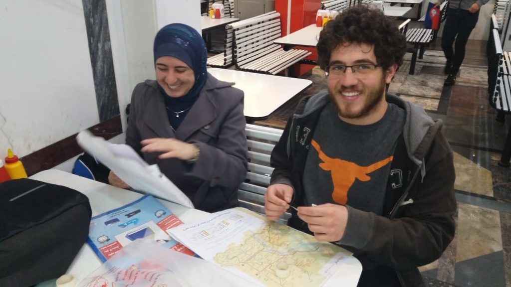
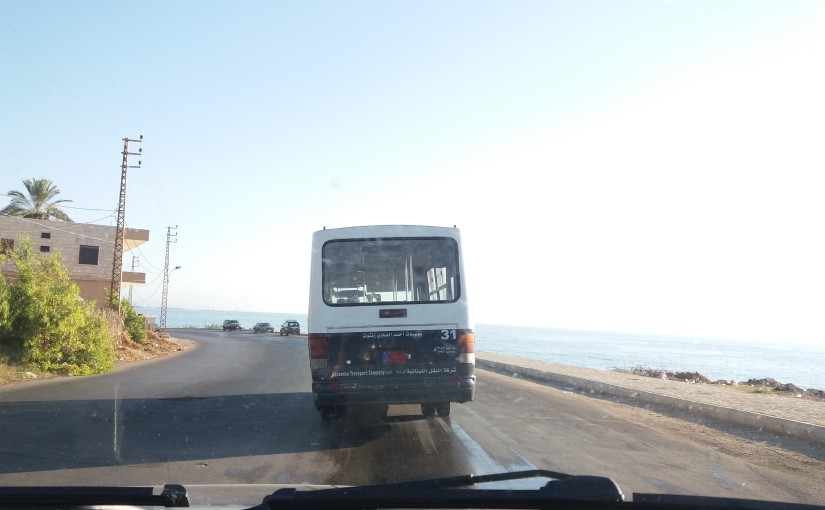
It may have been a Sunday, but that didn’t deter the Bus Map Project team from taking some bus maps and heading out for work. Joining forces with the production team of Beirut Mini Maker Faire, we sat down for some map prepping. The aim was to hang up as many maps as possible on buses, from lines 2 and 12.

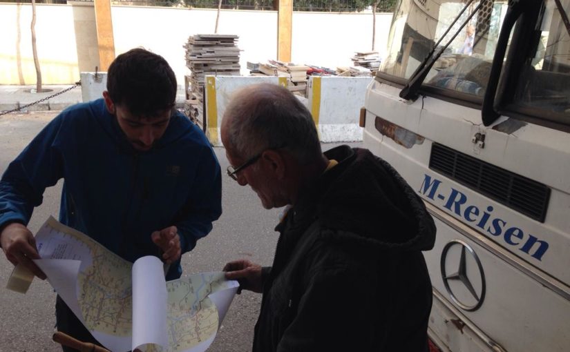
We moved out early, energized and prepared to take the challenge head on. We were met with an amazing, cooperative spirit from the bus drivers. In fact, some drivers came in and helped out! The head (“mas’oul”) of the bus lot even took 16 more maps to distribute amongst the remaining buses.

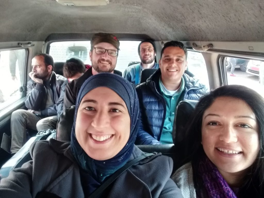
Afterwards, we took Bus Number 12 to Cola, where we took a van heading out to our next destination: Saida! 45mins and a couple of selfies later, the team reached the beautiful city. Encouraged by the great weather and welcoming bus drivers, we hung up an additional set of maps in Saida’s main van lot.

The Saida van lot drivers loved the Greater Beirut Bus Map so much that they inquired about the one for the South. We assured the drivers that the map is a work in progress — we will be working hard on getting it done! With their help, of course!

Feeling triumphant, we treated ourselves to some falafel and a boat ride around the islands. After such a successful day, we started heading back to Beirut, dreaming of bigger campaigns. But while on the road, we were surprised my messages from some of the drivers we’d met on line 2 and 12.

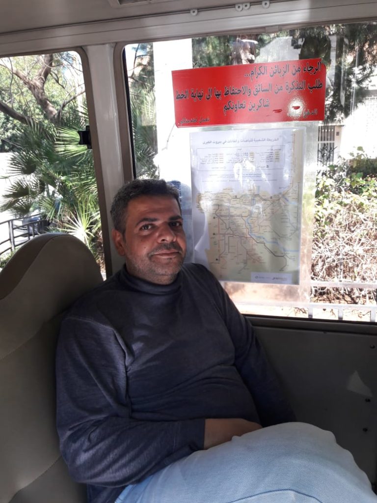
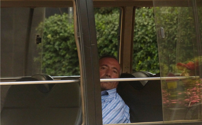
They were sending us photos of themselves with the map! Each of the drivers had taken a copy and expertly set it up in his vehicle — then posed with it! The drivers also expressed their deep gratitude to the team and congratulated them on such a wonderful effort. This was the biggest pat on the back the team could have received.

All in all, Sunday was a day to remember by both teams. But the real treat here is: can you #SpotTheBusMap? Stay tuned for additional news and a couple of surprises! From all the members of Bus Map Project, we wish you always have a great bus ride!

#HerBus: “The buses do exist; the map simply tracked them down”—Youmna’s story

We are always happy to receive stories of riding the bus, particularly when they highlight the diversity of gendered experiences on Lebanon’s transit, as part of our occasional but still ongoing #HerBus series. And these stories are even more special when they intersect with our own!

Youmna got in touch and told us how Bus Map Project co-founder Chadi Faraj’s app had a significant impact on her mobility in and around Beirut.

Fun fact: googling how to get to Fanar by bus was the exact same way our team first got together!

***

Being a Beiruty girl, who loves to go out, but is living outside of Beirut without a car, has never been easy.

Needing a family member or a friend to drive me, or paying a minimum of $10 to go anywhere, drove me to buy a car in my early twenties; lack of parking spaces and nervousness while driving from Bshemoun to work in Hamra drove me to give my car away and miss out on most events in my late twenties.

I created a car-less pattern that suited me: I go in the morning with dad go to work in Hamra; I stay after work in Hamra to feel alive, then make dad come and take me home.

I was once asked by a foreign friend while nagging about my problem why I didn’t take public transport? And at that time, I remember feeling ashamed while saying to him that we don’t have any.

The pattern I created went great until my dad needed to travel for two weeks and I left my job and needed a more economical method to go to Fanar to conduct a study, so I started googling, and by coincidence, I found the Lebanon Buses app.

Using the app, I learned how I could take the Number 15 from Corniche then jump into the Number 5. On the way back, I could take a service to Dawra and then the Number 2 to Hamra.

After using the app, I paid 3000LL instead of 30,000LL per day, and I became curious about how I could use more buses.

When I shared the app and map with my friends, half of them said: “you wish!” And I was so pleased to tell them that the app is correct; that the buses do exist and the map simply tracked them down.

With every bus ride, there is a story. They’re safer and funnier than taxies, so hopefully I will be sharing these stories with you as they come along.

From City to Studio and Back: Design as Civic Action

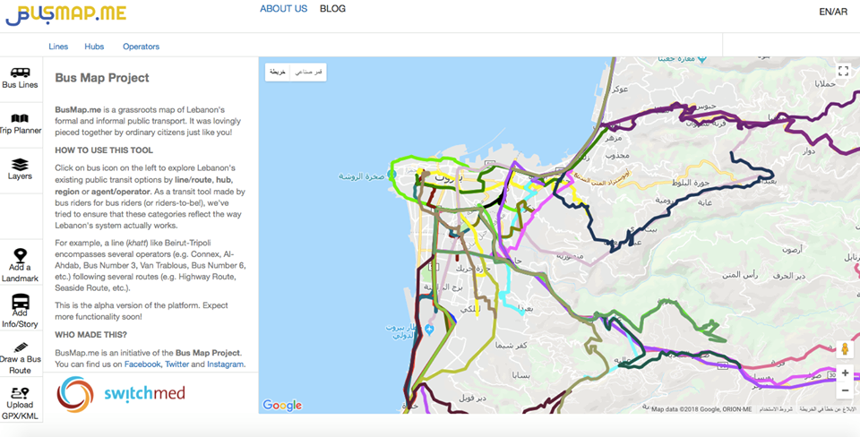
To what extent is it appropriate to formally map an informal system? Can collective mapping help spark new ways of thinking about public transit in Lebanon? These are some of the questions raised by Bus Map Project’s participation in Beirut Design Week this year, when we launched our second prototype bus map of Greater Beirut and the alpha version of our online transit platform BusMap.me, a participative tool that seeks to crowdsource, clarify and spread information about the people, places, voices and traces of Lebanon’s transit system. Will you join us on board?

By Mira Tfaily and Jad Baaklini


June 23, 2018. Photo by Moussa Shabandar


Slow-Hacking Beirut’s Bus Map

Beyond the brute fact of mapping, Bus Map Project has always been driven by a desire to disrupt the traditional talking-points around public transport in Lebanon. Our project is patient and incremental because it insists on a fresh perspective on urban change. By making visible the range and regularities of our ubiquitous yet little-understood transit system, our map is trying to prove a point; it is advocacy by other means. And what it demands is that we start taking this transit system more seriously.

Yet, in doing so, the bus map tends to hog the spotlight as an artifact — a solid, already-accomplished matter of fact — pushing these motivating questions into the background, like any utilitarian tool eventually does. How, then, can we (re)turn the map, from an object of design, back to a matter of concern and a locus for civic action? How do we keep its point — its advocacy by other means — at the forefront?

More importantly, how do we keep this traffic flowing both ways? From tool to platform and back again, how do we break the silos between expertise and experience (design and ridership) to widen the sense of shared ownership to encompass as many civic actors as possible?

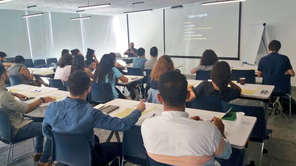
As part of Beirut Design Week, and in partnership with Public Works Studio through their Forum on Cities and Designers, Bus Map Project had the incredible opportunity to organize a workshop on June 23th, 2018, entitled “Slow-Hacking Beirut’s Bus Map.” The idea of “Slow-Hacking” — coined at first in jest by Public Works’ Monica Basbous — came out of our concern for making sure that this map that we’ve been lovingly piecing together, route-by-route, for a while, remains an open question: open to change in itself, and open by catalyzing debate over the cities we live in and reproduce every day. The word is meant to appropriate the can-do attitude of hackathons — that helpful sense of agency and confidence that we want to see more of in urban advocacy in Lebanon — while rejecting the less helpful sense of misguided urgency and false efficacy behind the fantasy of quick fixes.

Over the course of three hours, we attempted to prefigure the slogan recently displayed on the state’s own buses (“shared transport is a shared responsibility”), while inviting participants into our process. Through an interactive presentation, we shared Bus Map Project’s view of mapping as a form of activism — the kind that not only pushes for recognition of the existing system of transport now marginalized within the dominant doxa, but that also stirs up conversations about the mobile inequalities that traverse it.

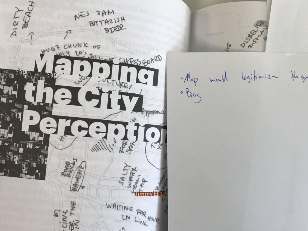
We tried to keep our presentation anchored in ourselves, as riders and advocates. We shared the context of our own meandering journeys into the project: Chadi’s early development work in 2008, Jad’s research and activism interests in 2010, Sergej’s work with Zawarib in 2012, and Mira’s journalistic introduction to our work in 2016 before joining as a researcher in 2017. From this personal and collective perspective, a lot has changed since the seed was first planted when someone once said that creating a bus map for Lebanon was one step too far (because a map would legitimize something ‘substandard’). Today, very few people will argue that public transport doesn’t exist in Lebanon — the lacuna where it all began.

From that point of view, much of our work is done; thank you for tagging along, and we hope that by foregrounding the ordinary ways that our personal stories became entangled in the politics of this often-mystified thing called the city, this small project can serve as a case study that inspires you and others to adopt similarly incremental approaches to seemingly intractable problems.

From a wider perspective, however, our work has only just begun. And we need your help to keep moving forward.

Photo by Chadi Faraj


Whose Streets? Our Streets

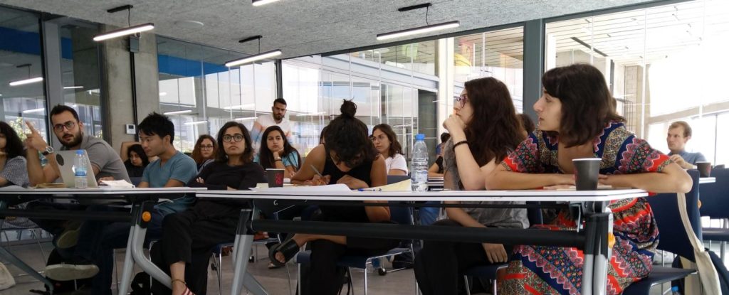
The workshop participants came from diverse backgrounds (architects, GIS specialists, urban planners, graphic designers, etc.) but shared overlapping interests. We opened the session by asking everyone to share their understandings of, and experiences with, Lebanon’s buses. Some came to the event with a lot of experience riding transit; others were curious and wanted to learn more. Some had initiatives of their own, like a WhatsApp group to share information with newcomers on how to get around Lebanon by public transport and a “mobility transformation” Meetup.

This personal approach helped us keep the discussion rooted in the city as a lived experience, far from the technical abstractions that create artificial and disempowering distance between our reality as ordinary practitioners and the infrastructures we help reproduce every day.

To emphasize this idea, our presentation of the basic features of Lebanon’s transit system turned the usual definition of public transport on its head: instead of starting at ‘the top,’ drawing conceptual contours and differentiating ‘para-‘ from ‘-transit’ proper, we privileged the concrete reality of riders first: their flesh-and-blood facticity, their cosmopolitan diversity, their eyes looking directly into yours, demanding recognition and ‘equal access’ to visibility.

When we put things in this way, we swerve very close to romanticism. That’s fine. This is because the simple profundity of the person is the foundation of everything we do. From this understanding, we define public transport as first and foremost a transport public. From that, we branch out and begin to notice the spaces of conviviality that connect user to operator, bus to system, street to map. On this foundation, we clarify our shared stakes in combatting misinformation and stigma (that perennial problem that we mustn’t underestimate) and keeping transit advocacy rooted in real lives and livelihoods. Only then do we dare to offer definitions.

Lebanon’s transit system is best understood as a network of networks, gelling together along several spectra of agglomeration and ownership:

  • state-owned (OCFTC) ↔ municipally-owned (Ghosta, Dekwene) or organized (Bourj Hammoud)
  • corporate (Connexion, LCC, LTC/Zantout…) ↔ family businesses (Ahdab, Sakr, Estephan…)
  • route associations or fleets of a few owners with shared management (Number 2, Number 5, Van 4…) ↔ loose networks of individual operators (Number 22, Bekaa Vans…)

When our discussion turned to these concepts, a lot of debate was sparked, including a conversation on the controversial BRT system that we’ve blogged extensibly about. Hence, one consequence of taking the existing system seriously — people first, places second, conceptual categories last — is making the question of working with what exists (joud bel mawjoud) much more realistic and pressing. Why can’t we invest in existing people?

Connecting the Map to the City

After the presentation, everybody was invited to pitch in and make our map their own: What would they add? How would they represent informal landmarks? What changes would they propose to make the map more accessible?

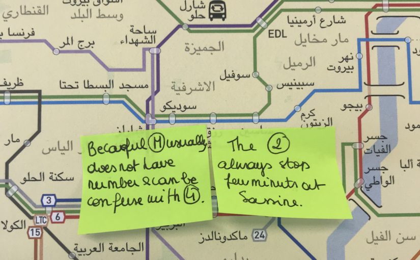
Many participants thought that the Number 5 and Number 2 bus were the same, when the two lines separate at Sassine heading north. Misapprehensions like this point to the importance of involving more and more people from ever-wider circles in this collective project; indeed, the majority of us agreed that collective and incremental design can be a powerful language and tool for encouraging a change of mentality needed to shift our society towards more sustainable and just mobilities. June 23 was Day 1 of hopefully many more in this new phase in our project, and we will continually look for more ways to involve as many people as possible in the making and hacking of our collective output.

One tool we hope will facilitate this is our online participative platform (BusMap.me), launched during the workshop. It’s still in alpha development, but we’re so happy to finally make it public — a big thank you goes out to Chadi and our grassroots mappers for their hard work! BusMap.me aims to become a hub for crowdsourcing GPS data and annotating Lebanon’s transit routes with photos, tips and stories — material that can’t fit into a single, static bus map, but which is pretty much the essence of mapping our word-of-mouth urban geography, Lebanese-style.

The platform is imperfect and incomplete by design — and we mean it when we say that this is by design; we refuse to wear the crown of authority over this endeavor and proudly wave the banner of engaged amateurism in the city, with stubborn determination — because beyond mapping, the platform is meant to be an invitation for people to engage with shaping the system, contributing what they can to a collectively-owned map that celebrates the cacophony of voices that constitute Lebanon’s transit system. Think you can do better? Get in touch!

Our involvement in the Beirut Design Week continued on June 26th, 2018, when Sergej presented our work and his design process during a roundtable organized by Public Works entitled “Between City and Studio: Connecting the Map to the City”. Building on the previous participative workshop, he emphasized the activist role of the mapper and map designer. Every map is a collection of choices — deciding how and what to display influences the collective imageries and tropes that either challenge the established urban mythology, or, on the contrary, contribute to furthering the gap between urbanist discourse and lived reality. Mapping is and should remain an open question and we hope that more and more people recognize and join this political process that we are catalyzing.

Later that week, some encouraging signs of this happening emerged! We had the pleasure of attending YallaBus’s first meet and greet, where they facilitated their own participative discussion to debate the mapping of Lebanese bus routes, and presented the first version of their transit app. Taking inspiration from our work and building on our second prototype, YallaBus has started working on their own static map; during the event, attendees also came up with new and exciting solutions to face the challenges of mapping and visualizing an informal system.

We also took the opportunity to raise some questions about YallaBus’s release of the live GPS feed of Number 2 in Beirut. While we are excited to see progress in this live-tracking work, this beta release poses privacy and security concerns, since the location of buses (and, presumably, the homes of bus drivers) in the initial release was on display, potentially endangering the drivers. We are happy that YallaBus has been open to such feedback and look forward to seeing how their app develops.

We are also enthusiastic to see more events and gatherings of this type happening in the future. Let us keep catalyzing the change we want to see! Proactively, pragmatically, sometime’s poetically — our cities are ours for the (re-)taking.

Has the Existing Transit System in Lebanon Finally Been Recognized? / هل بدأنا اخيرا بالاعتراف بوجود نظام نقل شعبي و غير رسمي بعد ان كانت حتى النقاشات لا تذكره ولا تعبره؟

On October 25th and 26th, we had the pleasure and honor of being invited by Dr Tammam Nakkash to a symposium organized at the Order of Engineers and Architects called “Towards Organized Public Transport in Lebanon.”

في ٢٥ ت١ ٢٦ ت١ ٢٠١٧ ، لقد كان  لنا الشرف بتلبية دعوة من قبل الدكتور تمام نقاش للمشاركة في سيمبوزيوم في نقابة الهندسة في بيروت بعنوان ” نحو نقل عام منظم”.

We were first introduced to Dr Nakkash almost seven years ago, as a keynote speaker in an event called “Public Transportation, Public Concern,” where he lectured on all the necessary, institutional prerequisites to transport sector reform in Lebanon. The message he clearly articulated that day in December was that there were no apolitical quick-fixes to introducing new transport modes in the country, and in doing so — in calling for real “champions” of public transport — Dr Nakkash helped plant the seed for what eventually became the Bus Map Project in 2015. So for that alone, we are thankful for his interest in our work today.

كنا قد تعرفنا الى دكتور نقاش منذ حوالي السبع سنوات كمحاور رئيسي في مؤتمر “النقل العام شأن عام” حيث حاور بكل الحاجات الاساسية من قوانين واجراءات لاعادة الاعتبار للقطاع النقل واعادة تنظيمه. وقد اعلن بشكل واضح ان لا حلول سياسية سريعة –.
فبهذا، ومن خلال دعوته الشبابية ل “الأبطال”  في احياء القطاع، يكون الدكتور نقاش زرع البذور الاولى لما اصبح يعرف بمشروع خريطة الباص في ال ٢٠١٥. لذلك نشكر اهتمامه في مشروعنا اليوم.

The other important detail we remember from that day in Masrah el-Madina was a question posed by the only politician in attendance, MP Ghassan Moukheiber, who, after listening to the problems of congestion in Beirut and the bright visions of Bogota, politely yet firmly asked to hear more about the existing transit situation in Lebanon. The panelists had very little to say. One speaker admitted she had taken a bus in Beirut only once in her life, having vowed to never repeat it, because it was too slow.

الشيء الاخر الذي يجب ذكره عندما نراجع ذكرياتنا في مسرح المدينة هو سؤال من قبل السياسي الوحيد الذي كان حاضرا، النائب مخيبر، عن نظام النقل الموجود فعليا الان في لبنان، وذلك بعد استماعه لمشاكل زحمة السير والحل الذي حصل في بوغوتا وغيرها من المدن النموذجية. فالمحارون كان لديهم القليل ليقلوه حتى احد المحاورات قد اعترفت انها اخذت الباص مرة واحدة فقط في بيروت طوال حياتها وانها لن تعيدها مرة اخرى بسبب بطئ الباص.

Fast forward to 2017. The two-day event at the OEA began with a recurring leitmotiv that made us feel that plus ça change in the way that the “public concern” of public transport was conceived. “Detailed and updated plans to implement change in Lebanon have been studied for over 10 years,” we heard again and again, “but what has been failing dramatically is the enforcement and implementation.” From there, the different panelists and discussants focussed on the different ways to break through this institutional barrier of policy immobilism. Dr Nakkash’s presentation dove into more details about the causes of the status quo of stasis in Lebanon. Suggesting concrete solutions to address some very specific issues (e.g. architects and engineers who participated in the construction of buildings on lands owned by the OCFTC should be invistigated), he also highlighted one of the main problems of transit in Lebanon: the tie between transport funding and the government, that makes any plan correlated to possible institutional instability and lack of political will. This was one of the same prerequisites he had spoken about in 2010.

فلنعود الى ال ٢٠١٧ والى النهارين في نقابة الهندسة اللذان اعطا انطباع الى اعادة الاهتمام الى قطاع النقل من قبل المجتمع عامة والمهندسين والمختاصين خاصة. اكثر من عشرة سنوات ونسمع ان هنالك دراسات وخطط ومخططات للقطاع تدرس تعدل ولا تطبق. من هنا حاول المحاورون شرح ومناقشة السياسات التى جمدت هذا القطاع والعقبات التي وقفت في تطوره.

محاضرة الدكتور نقاش حاولت الغوص في تفاصيل هذا الوضع مقترحا حلول عملية لمواجهة بعض المشاكل (كأقتراح العمل على سحب تراخيص المهندسين الذين شاركوا في التعدي على املاك مصلحة الحديد والنقل المشترك). وشدد على مشكلة من المشاكل الاساسية للقطاع النقل في لبنان وهي الربط بين ميزانيات النقل والحكومة التي تعاني من عدم الاستقرار وعدم ايجاد الارادة السياسية لتطوير القطاع .وهذا ما كان صرحه في محاضرته في ال ٢٠١٠.

Nakkash elucidated how he had been suggesting for years a simple solution to the imbroglio of overlapping responsibilities between the OCFTC, the Ministry of Public Works and Transport and the municipalities: the creation of a higher, centralized transit authority that would bypass the frustrations and disentangle the bureaucratic knots by having its own fund, separated from the government’s budget, which only conspires to suffocate projects at birth. One example he gave was the rejection of the BRT plans by the Municipality of Beirut: in his view, the presence of an independent transit authority would bring consistency to transit strategies.

نقاش صرح واعلن كم يعاني لسنوات من تضارب الصلاحيات بين الادارات والوزارات ومصلحة السكك الحديد والنقل المشترك والبلديات المسؤولة عن القطاع، وانه منذ زمن طالب بأنشاء هيئة مستقلة مسؤولة للنقل لديها كل الصلاحيات لتكسر البيروقراطية الموجودة وتتمتع بأستقلال مالي تستطيع من خلاله  تمويل طول  مدة مراحل المشروع، من التخطيط الى التنفيذ الادارة اليومية حتى لا تموت المشاريع في مهدها كما يحصل الان. واحد الامثلة الذي اعطاها رفض مشروع الباص السريع من قبل بلدية بيروت ومن وجهة نظره وجود الهئية المستقلة للنقل سيعطي قوة وتكامل لخطط واستراتجيات النقل.
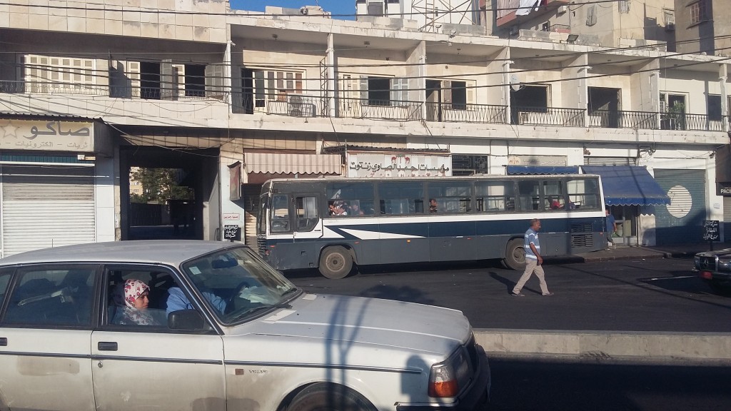
LRT in Saida

While it was inspiring to see Dr. Nakkash’s tireless fight to save policymakers from themselves, the issue that was most pertinent from our perspective was his challenge to the mainstream definition of public transport that we often hear in casual and even activist conversations: “Public/Shared transport is not defined by the entity who owns it and operates it.” Rather, Nakkash argued that public transport is characterized by fixed routes, fixed stops, fixed schedules, and access for everybody in exchange for a fee. While this definition of public transport may seem to exclude Beirut’s existing transit at first glance, it certainly opens up much more room for understanding how this system fills many gaps — and hence, meets most criteria — of more formal systems.

ورغم كل الجهد الذي صرفه الدكتور نقاش في المؤتمر لمحاولة تبيان العجز السياسي والتنظيمي في منظومة النقل، الا اننا يهمنا بشكل خاص اظهار تعريف النقل المشترك او العام او العمومي حسب ما عرفه دكتور نقاش والذي لطالما كان موضوع جدل بين الناشطين في القطاع.

فعرفه بأن النقل العام او المشترك او العمومي و هو نقل لا يهم صفة ملكيته او تشغيله، اهو قطاع عام او خاص، انما هو النقل على خطوط ثابتة محددة مسبقا يتم الصعود والنزول في محطات محددة ويعمل حسب جداول و توقيتات معلنة واستعماله متاح للجميع الراغبين يشتركون مع غيرهم مقابل بدل مادي. وهذا التعريف لا يستبعد النظام الغير رسمي المستعمل في بيروت بشكل كامل، بل يفتح المجال امام فهم كيفية عمل هذا النظام وملئ النقص والحاجات للناس ولديه الكثير من النقاط والايجابيات

Using the example of the Van Number 4, which takes advantage of the unregulated environment to reach a dynamism that formal transport could never compete with, Nakkash called for the formalization of the line to a certain extent, and hence, acknowledged the need for planning for integration, and not exclusion.

إستناداً على مثال الفان رقم ٤ الذي استفاد من عدم وجود بيئة تنظيمة للقطاع والذي وصل الى دينامكية لا تستطيع الانظمة الرسمية التنافس معه فيها، دكتور نقاش طلب بأيجاد اطر تنظيمية لهذا الخط، والتوجه نحو الدمج وليس نحو العزل.

الاشخاص الذين يعملون على موضوع النقل المشترك في لبنان يجب ان يتعاملوا مع قطاع النقل الغير رسمي وكذلك في العالم اذ انها جزء من التحديات التي تؤثر على القطاع النقل والتنقل.

The people whose job it is to plan public transport in the MENA region and in Lebanon have to address the question of informality, as well as global challenges that affect transit and mobility everywhere. This is what Dr Ayman Smadi, former Director of Traffic and Transport at the Greater Amman Municipality and current Director of the MENA branch of the UITP, emphasized in his keynote speech. One of these challenges is the penetration of private companies like Uber or Careem in the transit market, a phenomenon that is more striking in a country like Lebanon, where transit is almost wholly run by private operators due to endemic state neglect. To what extent is it possible to create a holistic, national land transport strategy that integrates all the stakeholders from the public and the private sectors? The acknowledgement of the existing system is an obvious prerequisite, as well as a state vision that is transparent and which is as concerned with addressing sociocultural attitudes as it is on built infrastructure.

هذا ما تحدث به الدكتور ايمن الصمدي المدير السابق للنقل والسير في مدينة عمان والمدير العام للمتوسط في الاتحاد الدولي للنقل العام واكد عليه في مشاركته. واحد هذه التحديات دخول شركات الخاصة الى القطاع وخاصة اوبر وكريم وتأثيرها على القطاع خصوصا في لبنان حيث القطاع الخاص لديه اليد الطولة في تسيير الخدمات في ظل غياب الدولة.الى مدى نستطيع خلق خطة واستراتجية ناجحة تجمع كل الاعبين المساهمين في القطاع من القطاعين العام او الخاص؟ الاعتراف بالنظام الموجود هو خطوة مطلوبة واساسية كما رؤية الدولة مع الشفافية التي تواجه وتعالج االمشاكل الثقافية والاجتماعية لبناء البنى التحتية للقطاع.

Even though most panelists still saw our bostas, vans and minibuses as a temporary gap-filler that should be replaced, the fact of even acknowledging their existence in a setting like this was an important step forward towards integration. While seeing them as insufficient, Jad Tabet, presiding head of the OEA, listed these modes in the options available for citizens who want to get around the country: “There isn’t in Lebanon any choice for mobility except private cars, services, buses, vans.” Ramzi Salameh from the Road Safety Authority even took it one step further, encouraging the use of the actual existing system whenever possible.

جاد تابت نقيب المهندسين في بيروت صرح انه لا يوجد وسائل متاحة الان للاستعمال الا السيارة الخاصة,التاكسي والسرفيس والباصات والفانات وطلب بوجود انماط اخرى فعالة للنقل والتنقل .
وايضا هناك البعض من المتكلمين كانت ارائهم تتمحور حول قضية ايجاد بديل للنظام الباصات والفانات الموجودة الا ان ذلك نعتبره اعتراف بوجودهم وانهم يملؤون فراغ الموجود في القطاع بتقديم خدمات النقل وهذا اعتراف هام للدمج في المراحل اللاحقة.

As we pointed out in our presentation during the last panel, physical infrastructures and technologies alone are not sufficient for implementing sustainable change. This was further emphasized by Wissam al Tawil, president of the Scientific Committee of the OEA, who said that policies only oriented towards improving infrastructures are doomed to fail. The issue of transport in the country is not only technical, but cultural. The omnipresence of car culture was widely debated by MP Mohammad Qabbani, who is a member of the parliamentary workgroup on transport issues. Dr Christine Mady from NDU broke down the definition of infrastructure even further, dividing it into four categories: physical, social, institutional, and information/technological. Hence, a holistic shift in all levels is needed to re-orient urban development towards transit use.

” ليس في لبنان حالياً خيارات أخرى غير السيارات الخاصة سوى سيارات الأجرة والفانات والباصات، ولا يوجد اليوم خطة متكاملة لتنظيم وسائل التنقل هذه تسمح بالحدّ من الفوضى وباحترام معايير السلامة العامة”.
رمزي سلامة امين عام السلامة المرورية اخذ الموضوع الى بعد اخر بأستعمال النظام الموجود والعمل على تحسينه.

كم ذكرنا في مشاركتنا في المؤتمر البنى التحتية المادية والتكنولوجيا لا تكفي لتغيير مستدام وهذا ما اوضحه واكده رئيس اللجنة العلمية لنقابة الهندسة وسام الطويل، الذي قال: السياسات التي تتبع مسار تحسين البنى التحتية المادية هي تفشل دائما ولا يتخيل احد ان حل مشكلة النقل تكون بتوسيع طريق او مد جسور. والمشكلة في موضوع النقل ليست فقط تقنية انما ثقافية. هذا ما اوضحه رئيس لجنة الاشغال والنقل محمد قباني. الدكتورة كريستين ماضي من جامعة اللويزة فصلت البنى التحتية الى اربع اقسام: مادية،اجتماعية، تنظيمية، وتكنولوجية ودعت الى التحول الى التخطيط العمراني على شكل التنمية نحو العبور transit oriented development الذي يؤدي الى شعور الانتماء للمجتمع ويسهل الولوج الى الخدمات العامة.

In conclusion, we reiterate that the problem of (im)mobility in Lebanon cannot be solved through a set of top-down policies that keep ignoring the existing transit system and the daily livelihoods and reality of thousands of riders and workers that it represents. The OEA symposium has brought to the fore the obstacles preventing the implementation of a national transport strategy; but shouldn’t the first step for change be the use of the available and functioning transit system of the country?

في الخلاصة نكرر ان مشكلة النقل والتنقل لا يمكن حلها بسياسات تغيير فوقية تتجاهل النظام الموجود وحياة واقع الكثير من الركاب والسائقين العاملين في هذا القطاع، والذين لهم الحق في ابداء رأيهم ويكونو شركاء في القررات. وقد ابرزت الندوة في نقابة الهندسة العقبات التي تحول دون وجود استراتجية وطنية للنقل؛ لكن الا يجب ان تكون اولى الخطوات لها استعمال نظام النقل الموجود الفعال في البلاد؟

Dr Mona Fawaz from AUB closed the symposium on this note, with these very encouraging final words: “Decision makers need to be convinced by the culture of public transport. The main point that came out of these two days is that there indeed is an existing system and we need to use it when we can, because this is the first step towards change.”

الدكتورة منى فواز من الجامعة الاميركية لخصت السيمبوزيوم بهذه العبارات المشجعة: “المسؤولين يجب ان يقتنعوا بثقافة النقل المشترك. والنقطة المهمة بعد هذين النهارين هناك نظام موجود وندعو الى استعماله عندما نستطيع لانه هذه اولى الخطوات للتغيير”.

We hope to see more of Beirut’s transit champions riding the bus with the likes of us in the near future.

نأمل أن نرى المزيد من الأبطال في بيروت الذين يركبون الحافلة مع أمثالنا في المستقبل القريب


Symposium report prepared by Mira Tfaily, Chadi Faraj and Jad Baaklini
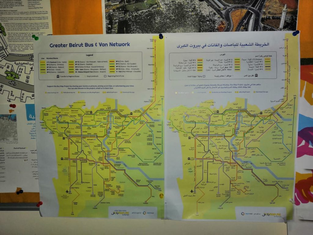
Covering ‘Cola’: The Collective Bus Map, Summer 2017

by Mira Tfaily

This summer, Bus Map Project gathered a team of volunteers from AUB with one aim: tracking as many of the bus routes that originate from Beirut as humanly possible. In this past month of August, we drew our focus on the Cola hub, a well-known transit intersection in the capital, to list and track all the routes departing from there in a grassroots and organic way. The ultimate goal of this collective mapping action is to produce a map pieced together by individual transit users so that more people get to know and trust this dynamic system of buses in Lebanon.

This is Ali, a driver we met while scanning the hub; he drives the oldest bus in Cola, dating back to 1973.

To the eye of the novice, getting around the Cola intersection can seem like an impractical imbroglio. However, as soon as one starts opening her eyes and engaging with riders and drivers, the entangled web of routes becomes almost limpid — maybe even enjoyable. To palliate the deficiency in state organization, the informal transit built its own tanzim, with bus stops for every route, coordination between different lines that pass through the same cities, and sometimes even set timetables.

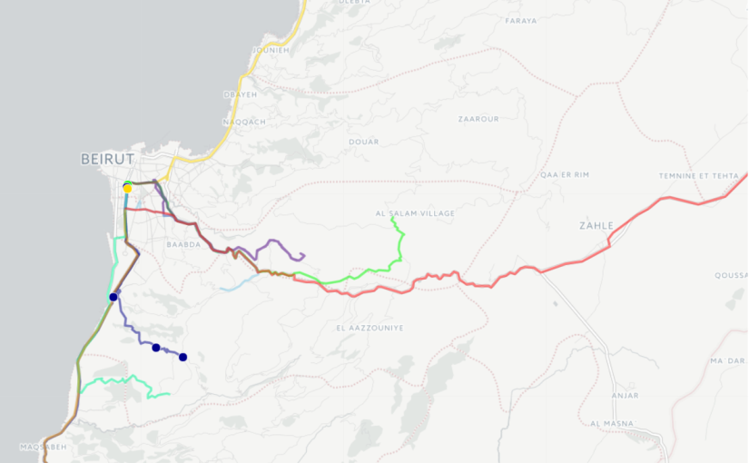
To get a sense of the full scope of the hub, our first step was to collect routes by word-of-mouth, or more specifically, word-of-twitter. We then went to Cola one morning and engaged with the drivers and riders to actually “scan” the hub, to get a clearer understanding and list all the routes originating from Cola. Once our list of almost 30 different routes was organized, our Collective Map Action truly began: the team of volunteers started tracking the routes and criss-crossing Lebanon to gather not only geographic data (i.e. point A to point B), but also facts on sizes of fleets, timetables, frequency of trips and prices of tickets.

For as little as 1500LL, the Collective Map Action provided us with a unique opportunity to (re)discover some beautiful — and less beautiful — places of Lebanon, and simply enjoy the feeling of drift and lull that takes over when one rides the bus only for the sake of discovery.

Sara and Sirene tracked a van tracing the route from Cola to Choueifat to Khalde, and back again. Here is part of that journey:

Cola to Chouiefat [Sara and Sirene]

Rashad went on a trip from Cola to Baakline:

Cola to Baakline [Rachad]

And Ali traced his way to Aramoun and Qabr Chamoun:

Cola to Aramoun/Qabr Chamoun [Ali]

Here, the first difficulty arose: while there indeed is a regular van that ends at Aramoun, the drivers often continue to Qabr Chamoun when some clients want to get there; this is what happened the two times we tried to track the van, raising the question: to what extent is it possible to produce a formal map that faithfully reflects a truly informal system? And shouldn’t this informality, instead of being seen as a lack of organization, be considered a dynamic and flexible vector of increased mobility? The design challenge is an exciting one, as any map worthy of reflecting Beirut needs to figure out how to communicate these nuances.

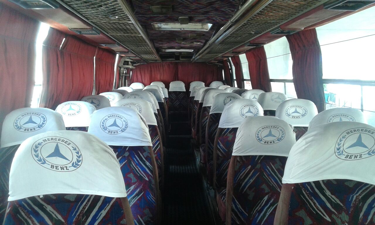
Interior of the bus going from Cola to Debiye

While the team prepares to wrap up Cola and track the last few obscure and infrequent routes, the Collective Map Action of this month also forces us to think about the trap of romanticization. Whenever we explained to drivers that we were riding buses only to figure out where they went, we were met with amused and startled glances, and even a little bit of “mesmerization” — particularly when we admitted that we quite enjoyed the rides; one female passenger on the Number 13 noted that “it’s because you do it for fun, you’re not stuck every day in two hours of agonizing slowness and traffic during your commute.”

While a major “edge” that our team has is that we indeed daily users of buses for commuting or for travel, this was a gentle reminder to be careful about exoticizing or objectifying ‘bus culture,’ and to keep in mind that public transport is always primarily a fulfillment of a basic economic and social need, and not some kind of privileged surrealist experiment.

Finally, this month brought to the fore the real value of privileging a grassroots approach to mapping, instead of conveniently having one single person track all the routes. While a collective approach is harder to manage, organize, and takes more time to build up momentum for, this methodology benefits from diverse perspectives, insights and experiences, and contributes to creating a map that reflects the realities of as many riders as possible. This, in turn, works to open up a conversation about broader social and developmental issues.

Collective Mapping: A New Way of Reclaiming Public Space?

How can a map become a tool to change your perception of urban environment? The Bus Map Project has been asking this question for two years now, trying to build support for a “Collective Mapping Action.” Last summer, we distributed a small batch of a prototype map of Beirut showing bus lines pieced together route by route by the small team. This summer, BMP has grown to include nine volunteers who are criss-crossing Lebanon for the second expanded edition of this map. In doing so, the team is not only participating in a civic service, shaping a map of public transportation that will benefit all potential users; they are also helping move the project to the collective level it was always intended for.


Collective Mapping: A New Way of Reclaiming Public Space?

By Mira Tfaily

Capturebmp

Turning every bus rider into a bus tracker, the idea of “collective mapping” represents a pragmatic approach to city systems that leverages daily life and first-hand experience in the service of cartography.

Sara and Sirene are two AUB Landscape Architecture students taking part in Bus Map Project’s collective mapping initiative this summer. “We had never taken the bus before, mainly due to the lack of information. So far, we rode it only twice, but it has completely shifted our misconceptions,” they explain enthusiastically.

By giving people their initial reason and motivation for riding the bus, Bus Map Project hopes that collective mapping can help get rid of the fear and uncertainty surrounding Lebanon’s non-formal transit system. In turn, mapping the system with diverse others can help open up spaces for new perceptions, patterns and behaviors. As the team put it in their first meet and greet sessions with volunteers: “Mapping is a tool. Community engagement is the point.”

The ultimate aim, then, is to build a broad community of bus riders who are passionate about improving the system through incremental and accumulated effort. That way, every bus user becomes a bus mapper and story teller, and is personally invested in shaping the collective vision of their city.

This approach transforms the idea of the map from a compartmentalized and technical design process best left to experts, to a collective conversation involving as many actors as possible, shaped by experience and not theory. Whether you are a student, a worker, a tourist or simply a curious wanderer, mapping Lebanon’s bus system collectively is a way that re-frames you and your environment along the way: one the one hand, a shift from being a consumer to being a (co-)producer, and on the other, a move from a major problem — of traffic, of chaos, of lack of regulation.. — to a great potential.

Maps are political, maps are sociological, maps tell stories, and above all, maps reflect choices: the choice of what you decide to mention in it, and what you leave unsaid. Instead of wondering why we don’t have a bus map in Lebanon yet, let’s join together and steer this conversation. So, how can you be part of the initiative?

1) Download a GPS tracking map for your smartphone (examples: Open GPS Tracker for Android, Open GPX Tracker for iOS, Gaia GPS for Android and iOS, Trails for iOS, etc.). Make sure it has the capacity to export GPX, KML or KMZ files.

2) Get on a bus at its point of departure.

3) Hit record on your app, and make sure your signal doesn’t drop as your ride a bus from beginning to end.

4) Email your file to hello@busmap.me with some background about you and your journey.


Bus Map Project is not only collecting routes: we’re collecting voices, experiences, stories… And we cannot wait to discover yours!

Interview: BMP on WhereIsMyTransport’s Interchange Blog

“Capturing routes on a transport industry that doesn’t follow the same roads everyday or have a structured schedule is a challenge. But this is an even greater hurdle in a city where many are unaware of or refuse to acknowledge the informally-run industry’s place in the city’s public transport network.”

Learn more about the thinking that motivates us in this post on WhereIsMyTransport’s Interchange blog.

Interview: BMP in Agenda Culturel

Merci, Agenda Culturel!

‘Le but c’est d’expérimenter, de pousser les photographes à s’intéresser à la question des bus tout en passant un bon moment .. Nous espérons vraiment que leurs remarques et observations sur les trajets, ce qu’ils auront remarqué en prenant le bus, nous aidera à développer notre cartographie et nos idées’.

And it’s happening tomorrow! To confirm your spot as a photographer in the Bus Map Photo Action, please don’t forget to register at http://frame.life/Events!

Interview: BMP in Banapook

“Though it sounds trivial, one of the main reasons the middle-class has notoriously avoided using Lebanon’s bus system is simply a matter of labels and maps. Where does this one go? Where are the bus stops? [..] What’s admirable about Lebanon’s millennials is that they aren’t naive to expect too much from public bodies and tend to proactively find alternative solutions.”

Thanks for the feature, Bananapook! <3

It’s interesting to reflect on the pragmatism that motivates us at a time when there’s a real chance that the same can-do spirit might make public policy more welcoming of our generation. Our vote is with all of you hopeful people. Good luck to us all!