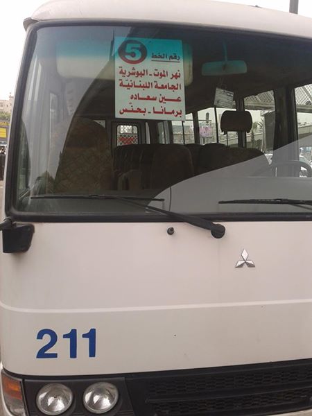
Don’t confuse it with the other Number 5, that goes from Hamra to Ain Saadeh.
Both 5s go to Ain Saadeh via Fanar, but each takes a different route through town: the OCFCT Number 5 via the Lebanese University (Fanar Campus) road, and the private Number 5 via ‘7ay al-Arman‘.
On August 22, a campaign based around the ongoing waste (mis)management crisis in Lebanon became much much more. The movement called طلعت ريحتكم struck a chord with people across Lebanon, and brought thousands into Riad al-Solh Square to voice their anger over a wide range of policy failures and socioeconomic issues. At the center of this discontent is the generalized syndrome of deadlock in governance in the country, but others have gone further in their diagnoses. Many have focused on the endemic culture of nepotism and corruption among the semi-feudal political class ruling the country. Others have struck at the root, focusing on the confessional system itself as the perpetual engine of division, unaccountability and immobilism. Others have dug even deeper into the capitalist system as the context of contexts for our problems.
In the days that followed that fateful Saturday, several factors have pushed and pulled the movement in different directions. First, there was the inexplicable and inexcusable state violence against protesters, which fueled anger and encouraged more people to join. Second, there were the fears of party-orchestrated infiltration and sabotage, and the resulting controversy among movement supporters over the classist and sectarian overtones of these fears, and the ways that protest organizers chose to respond to them. Finally, there was the plurality of proposals and counterproposals for the way forward with movement demands, stemming from the various criss-crossing analyses described above. By August 29, the movement grew far beyond its initial scope and framing as #YouStink, and became a true platform for mass political action.
This means that the visions, missions and approaches are now many. Where do we go from here?
Bus Map Project was conceived as a modest, small-scale intervention in the gaps between state neglect and policy-oriented advocacy. We chose a pragmatic approach that strategically set aside the twin issues of rights and demands. We stubbornly focused on the present — on the bus system as it exists today, without quick judgement or dismissal — because we felt that other pro-transit campaigns have either focused too much on the past (e.g. the state’s neglect of public transport) or too much on the future (e.g. a desired public transport system). More fundamentally, we chose an approach that would bypass the state altogether — with or without a president, with or without a parliament, with or without a responsive Ministry of Public Works & Transport, we want to begin collectively building our own tools that help us make sense of and navigate our cities.
We support the current climate of protest. We believe that more awareness of the systemic problems that produce so many failures across so many sectors — from housing to transport to the environment — is important. Our project has only just started, but we wish to contribute to this ongoing conversation sparked by #YouStink by calling for more small-scale, closely-allied, locally-based, and non-state reliant projects focused on the tail-end of the crises created by Lebanon’s broken system of governance. The movement’s broader slogans — anti-corruption, secularism, electoral reform, parliamentary renewal — are of vital importance, but we believe that Lebanon also needs solutions in the here-and-now. We need better representation, better institutions, etc, but we also need less dependence, less centralization, less delegation of our power to connect and work together as civic actors.
This is not a call to “de-politicize” the movement — that is impossible. It is, however, a plea for more fidelity to the immediate, to the concrete, and to ourselves. There is strength in numbers — a single-issue campaign acting alone will struggle to accomplish anything, but a sustained and focused project acting within a broad network of supportive campaigns is more likely to succeed, for the benefit of all. Yalla.
If you are interested in learning more about how you can help Bus Map Project, please do not hesitate to contact us.
‘These are the stories of citizens who head to Beirut and its environs for work, every day, from the four corners of the nation, and who return to their home towns and villages in the evening to ‘divide the bread’ of their workday with their families.’
Have a look at this very important article (in Arabic) that first ran in As-Safir Newspaper. The issue of public transport cannot be disconnected from the prohibitive price of rent and housing in Beirut, the over-concentration of jobs in urban centers, and other wider issues of demography.
Areas served by few or infrequent buses — called ‘transit deserts’ — reflect these socioeconomic patterns, and can often make them worse by skewing our choices of where to live and work. The lack of night services on many routes also affects people’s choices of where to go and who to interact with.
Mapping can help us figure out which regions are under-served by public transport, and in doing so, point to underlying inequalities that can be improved — but not solved — by better network coverage.
How are your day-to-day choices of where to live, who to meet, etc., affected by the transport system? Let us know on our Facebook page.
One of the trickiest aspects of bus travel in Lebanon is figuring out the best and most efficient spots to transfer between different bus routes with little or no walking.
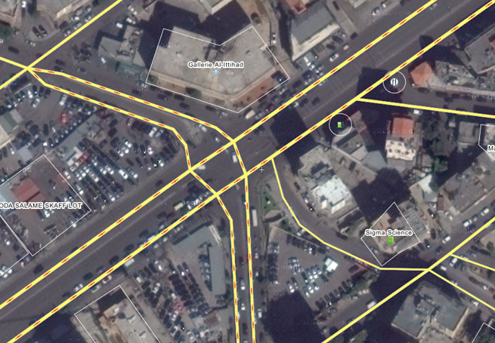
For example, the corner of Armenia Street and Cornich El Naher is a good place to hop off the Number 5 and catch the Number 6 or Number 15 to Cola Roundabout. For the return trip, getting off the Number 15 on Boulevard Sin el-Fil, near Gallery Al-Ittihad, is the best way to catch the Number 2, or get back on the Number 5.
What are your favorite tips and tricks for multi-stage bus travel?
Did you know that OpenStreetMap has a “Transport” layer for Lebanon? And that people have been adding bus routes to it by hand?
One prolific mapper told us about his motivations and experience:
“I moved to Lebanon in 2012. We did not intially have a car so we relied on public transportation. It was a bit frustrating at first because we did not know where the buses went etc. We eventually found the Zawarib book which has a Bus Map in the back. Unfortunately, the bus map only shows “areas” the buses goes to, which made it very difficult to know what street to go to catch a bus. Many times we waited on a street for a bus only to find out the bus actually goes down a parallel street. Or the apparent crossing of 3 routes in one place, but in reality 2 busses cross in one spot, and 2 others cross elsewhere.
When I first discovered OSM in February 2014, I saw the transport layer had a good portion of routes tagged, but mostly on the West side of Beirut down to the airport and only LCC routes. I had become familiar with more of the east side routes, so I added them. Mostly 2, 7, 8, some OCFTC, Sakr. I can’t remember if I’ve tagged any of 9 or 15. I was quite glad to find OSM and added the routes (or partial routes) I knew. I joined OSM primarily so that I could have a good bus route map to reference that showed routes on actual streets. I am not using GPS, but just my memory from when I rode the bus routes.
In mapping the bus routes I discovered that several roads were incorrectly labeled, routed, etc. So in order to put in the bus routes I had to add roads, correct one-way roads, even put in new intersections and roundabouts that were incorrect.”
Initiatives like OSM, Zawarib and onlinelebanonbuses.com need constant maintenance to keep routes updated. Any grassroots mappers out there who can help?
We are big fans of the فان رقم 4 Facebook page. With humor and one or two selfies, this page is humanizing a vital transport link between our capital’s centre and periphery.
According to the admins, the idea for the page began when one of them wondered why people check-in at Verdun or Gemmeyzeh, but not on the van. When we asked them what’s so special about Van 4 as a ‘place,’ they said: “it helps a lot of university students and employees. This is the main community on fb. The line passes through a lot of universities. Downtown. And Hamra. And maybe the bus drivers are special themselves. They’ve got character.”
If mapping is about increasing familiarity, then it needs more than lines drawn on a 2D surface.
In this spirit, learn more about the “ra’m arb’a” in this lovely piece over at Mashallah News:
“Going along for the whole ride exposes an intriguing “slice” of the city. At some points, it flashes past like a fast-forwarding reel of film: blurry and inexhaustible in its contrasting, contradictory impressions. […] At other times, bogged down in yet another traffic jam along Spears Street or at the Mar Mikhael Church intersection, the city lies motionless around you like a massive, panting beast. You finally have time to take a closer look at your surroundings. Maybe you can pick up again, if only for a fleeting moment, the fragile thread that ties all of these disparate places together into one city: Dahiyeh, Ain el Remmaneh, Chiah, Badaro, Ras el Naba`, Basta, Bachoura, Monot, Downtown, Hamra.”
This project’s name is inspired by the “snowball” approach of Rotaract’s “Bus Stops Project“, which you can read more about in this article written by our co-founder, Jad:
“According to project coordinator Jean-Marc Adaimi, the Rotaract Bus Stop Project was intended to “serve the community” by addressing an actual need, and “not just setting a goal and talking about it.” This meant servicing the country’s bus network as it is, even if it does not always “follow certain criteria,” as he put it, revealing a mix of pragmatism and far-sightedness to the project that’s not always seen in discussions of public transport in Lebanon.”
“Try to locate any place in the Lebanese capital and this, typically, is what you will hear: details and places, not the names of streets or their numbers. Whether visiting a friend for the first time or trying to find someone’s office, the best bet is always to find landmarks, not official addresses – they may exist, but probably won’t be of much help anyway, because no one really uses them.”
The same logic applies along Lebanon’s bus routes; informal ‘stops’ and ‘stations’ have developed near particular buildings, bridges and intersections.
Do you know Al-Ittihad? El-Hayek? Kuwaiti Embassy? Gallery Semaan?
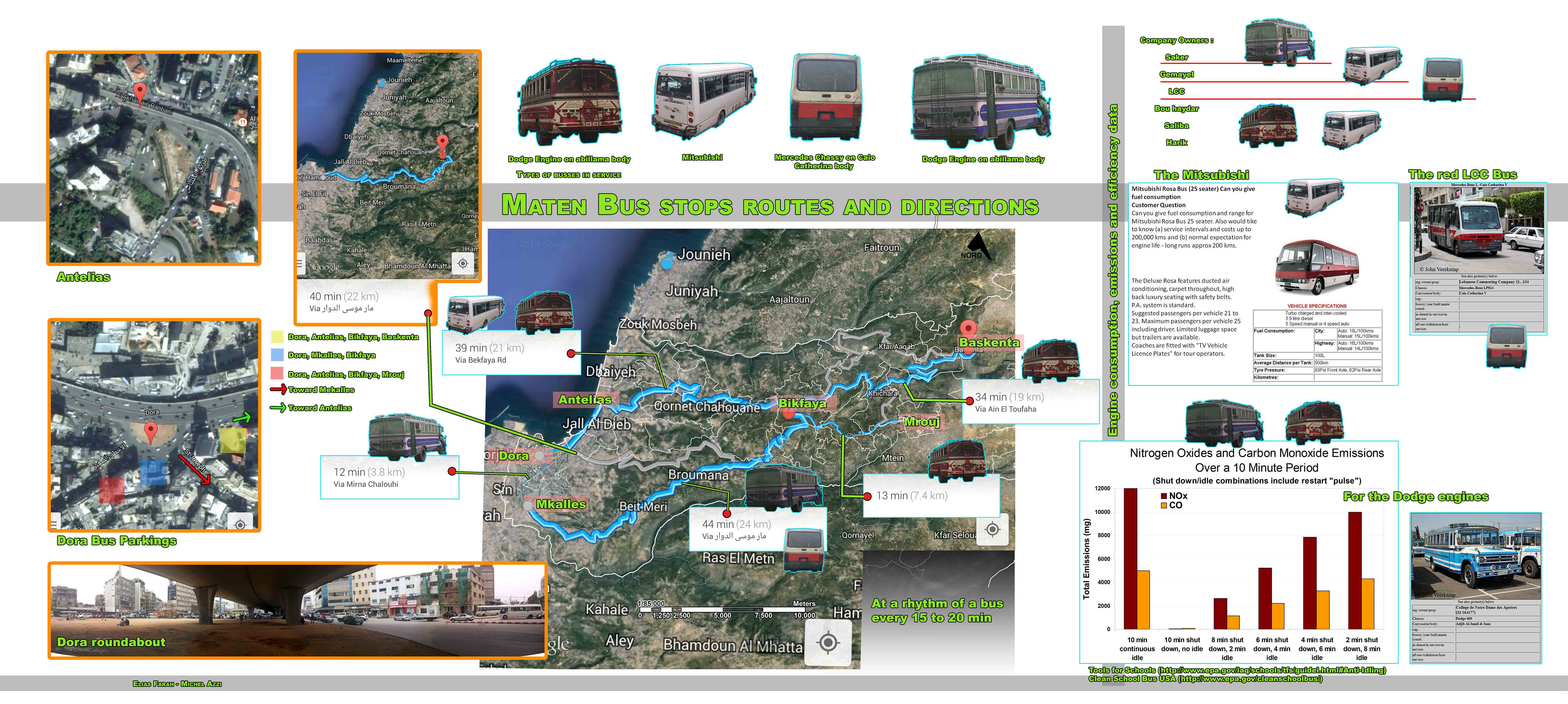
The following is adapted from a post by Bus Map Project co-founder Jad Baaklini, first published on his personal blog. It features research material produced by ODDD in the Maten.
For a country that’s turned the word ‘philosophize’ into an insult (bala falsafeh ya zalameh), we sure do drift into weird ontologies, without even trying. What’s the difference between existing and not really existing? Can something actually exist but not really really exist?
Infographic by ODDD+D16 (Courtesy of Eliesh SD). Click to enlarge.
I mean, clearly something that looks like public transport exists. Mitsubishi Rosa, Nissan Civilian, Fargo/Abi Lama — these are actual vehicles that very real people board every day to actually get from point A to point B. They have particular owners and particular drivers, who are associated with specific license plates and driving permits.
They gather in specific locations, which are part of complex and precise territorial arrangements that keep the tenuous peace between different fleets and route associations in this highly-competitive market. Fuel is consumed, money is made, and the public is transported from place to place. How can something so complicated be so easily dismissed?
For many people, the interactions and exchanges that make up this system are invisible or obscured. They may see a bus pass by from time to time, but they can’t tell if its a private shuttle or a school bus, or where it might be heading. So when these people say that public transport doesn’t exist in Lebanon, they do so out of a lack of familiarity with how all these seemingly chaotic parts — this clustering around Cola, that bus making this cab driver curse, etc — fit together. This is understandable. If you’ve never heard of Beirut, would you consider moving there? The same goes for Beirut’s bus system: if you don’t know that 1000 LL (less that $1) can take you all the way from Hamra to Ain Saadeh via Bourj Hammoud — a distance of more than 15 kilometers — you could not possibly begin to consider alternatives to driving there yourself (if you have a car) or paying up to twenty times as much for a taxi.
The problem of unfamiliarity is made more difficult by the fact that there are few tools or resources available to help potential bus passengers learn about these routes. Even when maps are made — and here is one attempt by Bus Map Project co-founder Chadi Faraj — there is still almost no dedicated road infrastructure to help you figure out where to catch these buses, on street level. It’s just something that — at the moment — you have to learn through trial and error, or by asking regular bus riders.
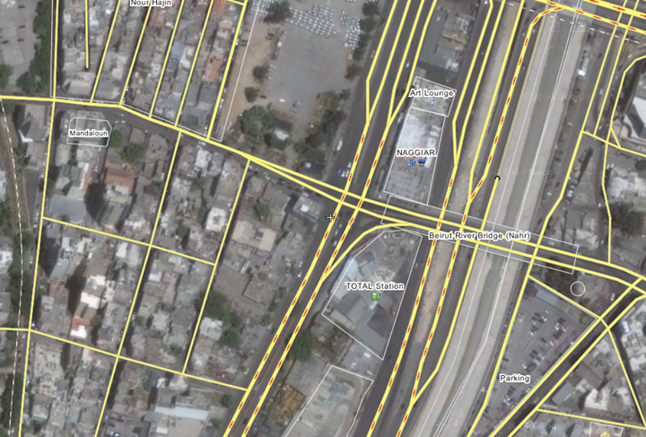
Learning to navigate a city this way can be a little bit intimidating at first. Everything seems random, but once you start paying attention, you’ll very quickly see that these bus networks have many regularities and routines: you don’t have to constantly guess where the Number 5/8 bus passes through Mar Mkhael on its way from Hamra to Ain Saadeh, for example — it’s always the same place: Badawi Street. The bus then turns the corner onto Armenia Street, usually stopping at the traffic lights, before then heading over the Nahr Beirut bridge into Bourj Hammoud. There’s no visible ‘bus stop’ anywhere along this route, but the bus will stop for you if you’re waiting for it.
Of course, not everyone is being literal when they say that public transport doesn’t actually exist. For these people, everything I just wrote is exactly why they believe that it doesn’t really exist — emphasis on “really.” This is because, according to their definition of public transport, what I described does not qualify. To them, a system that you have to “figure out” is no system at all, especially when its made up of a hodgepodge of gaudy bostas and second-hand minibuses imported from who-knows-where. To these detractors, what we have in Beirut is not “real” public transport for two simple and interrelated reasons: 1) “real” public transport must be publicly-owned (wen el dawleh?), and 2) “real” public transport must look, feel and behave a certain way (mrattab, eben 3ayleh, etc).
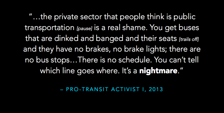
Or, as one activist I spoke to put it:
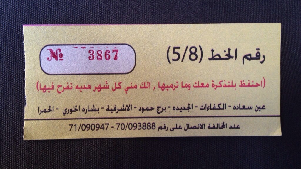
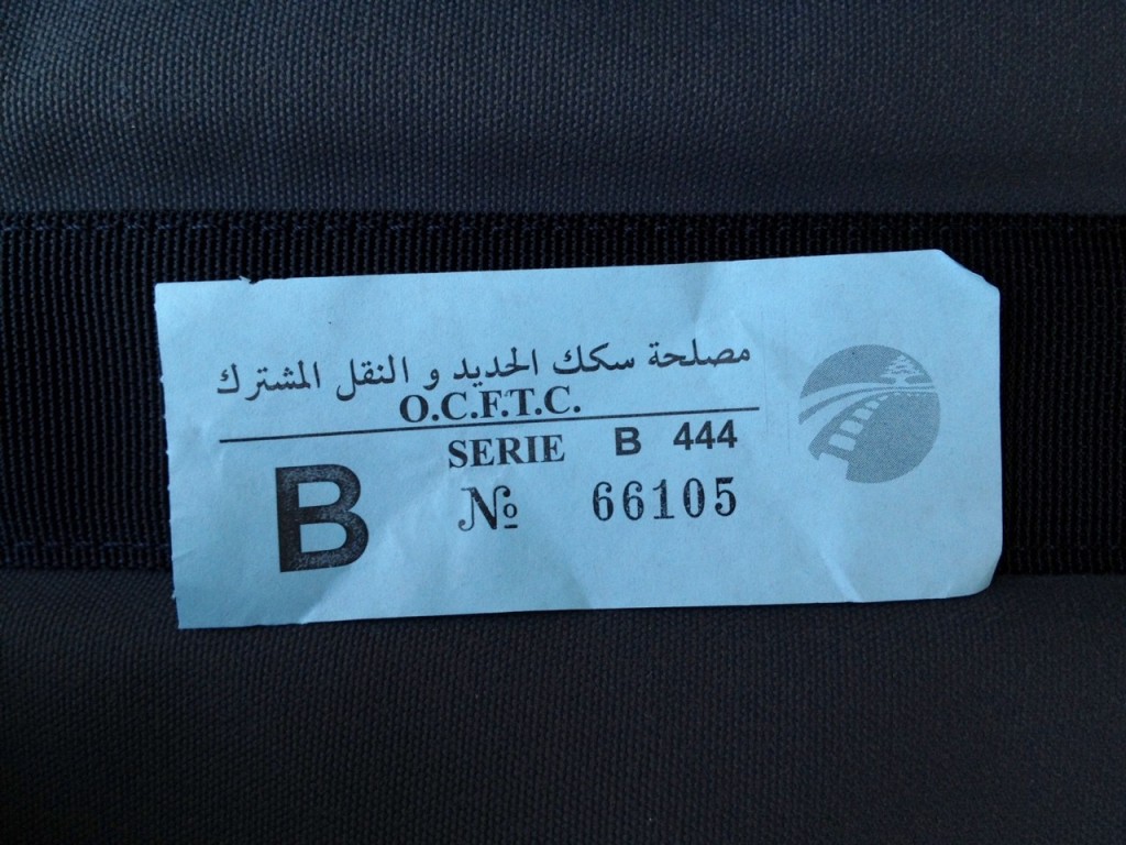
Let’s address these issues step by step. First of all, while state-owned bus routes do exist — that blue ticket above is from one of them — they certainly have their limitations. First, OCFTC bus fleets are very small, so trying to see one on the road can feel like being on safari. Second, their routes and designations overlap but don’t match with those of the larger and more popular, privately-owned fleets. So a Number 5 OCFTC does not go the same place as the Number 5/8 I described above, even though you can see both on the Jdeideh-Fanar-Ain Saadeh section of that route (and let’s not start comparing these numbers to those of vans). More harmonization between the state- and privately-owned bus networks would obviously be much more helpful for all of us, but I wouldn’t hold my breath waiting.
The question of what the government should be doing in this sector is, of course, very important, but it’s also very complex. Should the state buy new buses, or should it focus on providing road infrastructure? Should it try to compete with the privately-owned bus networks, or should it play the role of overall regulator? Can it help negotiate between competing fleets? If it runs its own buses, which gaps in the network should it fill? What passenger needs should it target? All of these are important questions that are sadly not on the table right now. But the fact that the state has neglected the public transport sector does not mean that those who are currently filling its service voids are illegitimate, or unimportant. Any lobbying of government that does not take into account the system that developed in its absence is doomed to failure. I would also call it unethical, even if, right now, it sometimes looks like the privately-owned system has no real interest in seeing the public sector revived. As Aoun (2011) argues in a paper she gave at the Transportation Research Board 90th Annual Meeting, a major obstacle to any meaningful change happening in the sector is “the uncertainty that [existing] transit operators face” (p. 8). Aoun writes:
“Although [operators] prefer more regulation and order under transit reform on one hand, they are also apprehensive of their future roles, on the other hand. Placing blame on each other also suggests a “prisoners dilemma” scenario in which each stakeholder operates individualistically, lacking the reassurance to cooperate in a mutually beneficial system.” (2011: 8)
If we’re serious about breaking out of this scenario, we need to urge the state (and pro-transit activists) to avoid stoking these feelings of apprehension and mistrust by dismissing the existing transit system wholesale.
This leaves us with the issue of how public transport should look, feel and behave. Some people will admit that some kind of bus system exists in Lebanon, but will then rush to add: but it’s filthy and unreliable. For these people, public transport will only really exist when it starts to look like an image they have of Paris, London or NYC — images that are transformed in their minds and rhetoric into simplistic approximations of imagined machine-like efficiency that doesn’t really match the way transit actually functions in those cities.
I don’t want to challenge these beliefs, and I certainly don’t want to romanticize the bus. There is certainly much room for improvement in the sector, most notably in the area of accessibility, as all buses currently available are not designed to accommodate wheelchair users, and pose a unique challenge to elderly passengers. While people who say that there are “no schedules” are exaggerating, the timeliness of buses can always be improved. But as a twitter friend once put it eloquently, the main question for people who want to see the system improved is: how can we dramatize the need for change without scaring people off from even trying what already exists? Do we have to dismiss the whole system to make a point?
My response to those who say they’d love to ride public transport if only public transport existed in Lebanon is this: it does, wallah, it does — now go try it, and see if you can find a way to integrate it into your life.